


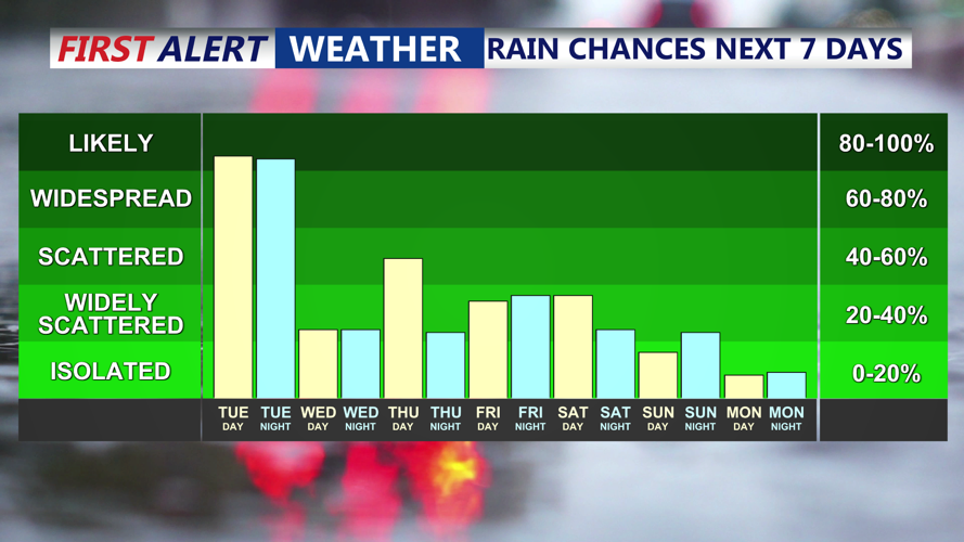


DELMARVA - A stretch of unsettled weather will continue to affect both inland communities and coastal towns from late Tuesday through early Wednesday, bringing steady rain, cooler temperatures, and a chance for thunderstorms across southern Delaware.
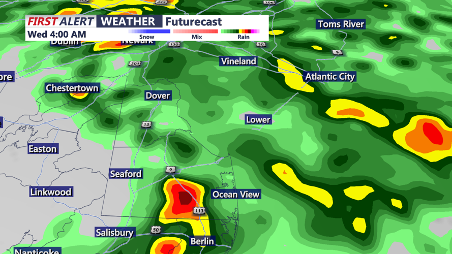
A persistent low-pressure system near the Gulf Coast is gradually moving north, sending waves of rain into the Delmarva Peninsula. Tuesday's weather began with light showers, but residents in western Sussex County and coastal towns from Prime Hook Beach to Fenwick Island can expect rain to become steadier and more widespread throughout the evening.
As this weather pattern evolves, a few embedded thunderstorms are possible Tuesday night, especially south of Philadelphia—which includes all of Sussex County. While the thunderstorm threat is limited, some stronger cells could bring gusty winds and brief downpours, particularly in areas like Millsboro, Georgetown, and Bethany Beach.
Rainfall amounts are expected to range from half an inch to as much as an inch across the region through tonight, with some isolated spots potentially receiving more.
By Wednesday, the core of the low-pressure system will be approaching from the southwest, continuing the trend of wet and cool conditions. Scattered showers will persist during the day, with isolated thunderstorms again possible. The Storm Prediction Center has placed much of the Delmarva Peninsula under a marginal risk for severe weather, citing warm and humid air creating instability and sufficient wind shear to support isolated strong storms. Damaging wind gusts would be the primary concern with any stronger cells.
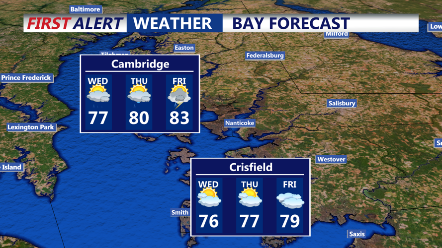
Temperatures will remain on the cooler side thanks to cloud cover and onshore winds. Highs on Wednesday will be in the 60s inland and near 70 degrees along the coast. Overnight lows are expected to fall into the 50s and low 60s.
The rain will begin to taper off Wednesday night, although isolated showers and a rumble of thunder can’t be ruled out into early Thursday morning. Drier weather is expected to return by Thursday night into Friday, although another system may bring more showers and storms by the weekend.
