


DELMARVA - A stormy start to the weekend will give way to drier and cooler conditions by Monday morning as Sussex County transitions from a wet pattern to more seasonable fall weather.
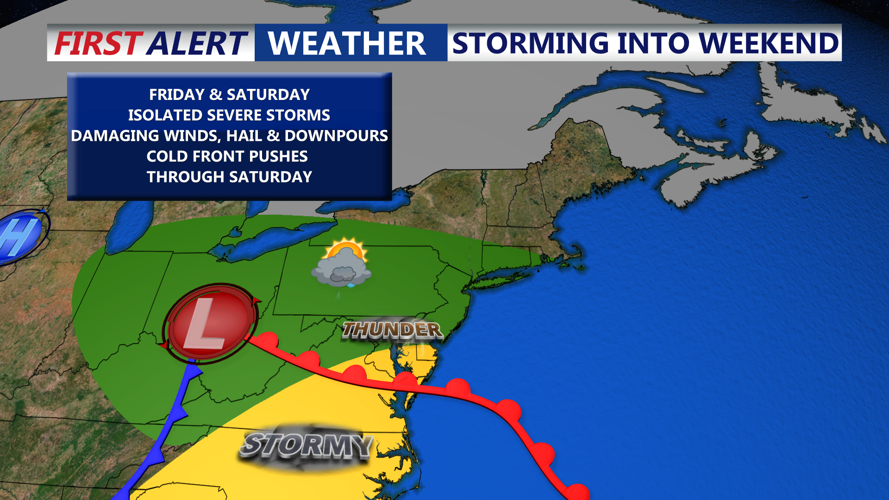
Saturday begins with lingering rain from Friday night’s system, especially in northern portions of Delaware. While the heaviest rain is expected to shift north by early morning, a soggy start remains likely for much of the county. Morning clouds and damp conditions may briefly give way to partial clearing before a second round of showers and thunderstorms moves in later Saturday afternoon and evening.
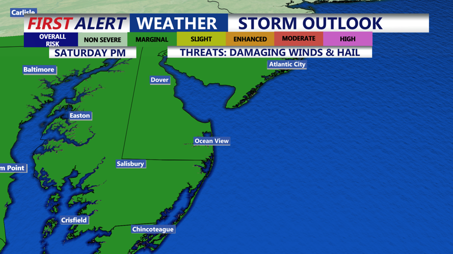
A cold front approaching from the west will be the trigger for this next round of weather. While instability remains somewhat limited, steepening lapse rates and modest wind shear may be enough to generate isolated strong storms. Gusty winds and small hail are possible in stronger cells. Given already saturated ground, any additional heavy downpours could cause urban and poor drainage flooding.
Highs on Saturday will remain mild, generally in the upper 60s to low 70s, but breezy conditions will develop behind the storms as cooler air begins to push in.
Saturday night into early Sunday will bring scattered showers and cooler air. Temperatures are expected to fall into the upper 40s and low 50s overnight. While a few sprinkles may linger into Sunday morning, especially inland, most of Sussex County will begin to dry out.
Sunday will mark a turning point in the weekend weather. While skies may start partly to mostly cloudy, increasing sunshine is expected as high pressure begins to build in. Winds out of the northwest may gust between 20 and 30 mph during the day, giving the air a crisp fall feel. Highs will top out in the upper 60s to near 70 degrees, with much lower humidity.
By Sunday night into early Monday, skies clear further and winds ease. Low temperatures will dip again into the 40s and low 50s. The cooler, calmer conditions will persist into early Monday as the region enters a more stable pattern.
Looking ahead to the workweek, high pressure will continue to dominate, bringing mostly sunny skies and a steady warming trend into the midweek period. Temperatures will rise from the 70s on Monday into the 80s by Wednesday, before the next weather system approaches later in the week.