


DELMARVA - Sussex County residents can expect a stretch of warm and tranquil weather from late Monday through late Tuesday, as high pressure remains the dominant influence over the region.
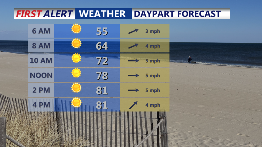
Forecasters say the center of the high will drift south and east, remaining just offshore through midweek. This positioning will maintain mostly clear skies and calm conditions, with light southwesterly winds helping temperatures climb. Highs on Tuesday are expected to range from the upper 70s to low 80s across the county.
A layer of smoke from wildfires burning in the western U.S. will likely remain aloft over the region, though there is only a slight chance it could mix closer to the surface and impact visibility.
Looking ahead to Tuesday night, the high pressure system is forecast to remain offshore, continuing to support dry weather through at least early Thursday. By late Thursday into Friday, a cold front approaching from the northwest could bring a return of unsettled conditions, including showers and possibly thunderstorms.
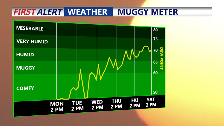
Temperatures are expected to rise further by the end of the week, with highs nearing or exceeding 90 degrees Thursday and Friday. Humidity levels will also climb, pushing heat index values into the 90s.
A shift toward stormier weather is possible by Saturday, as the cold front crosses the area. The combination of moderate instability and moisture could lead to isolated strong storms and heavy downpours. While Sunday may see a brief return to dry weather as high pressure builds to the north, a coastal low could bring rain chances back early next week.