



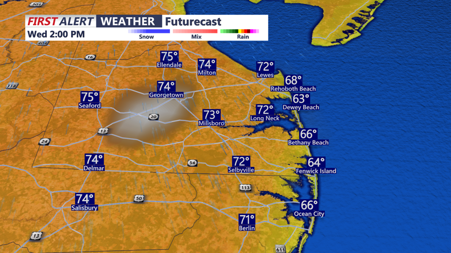

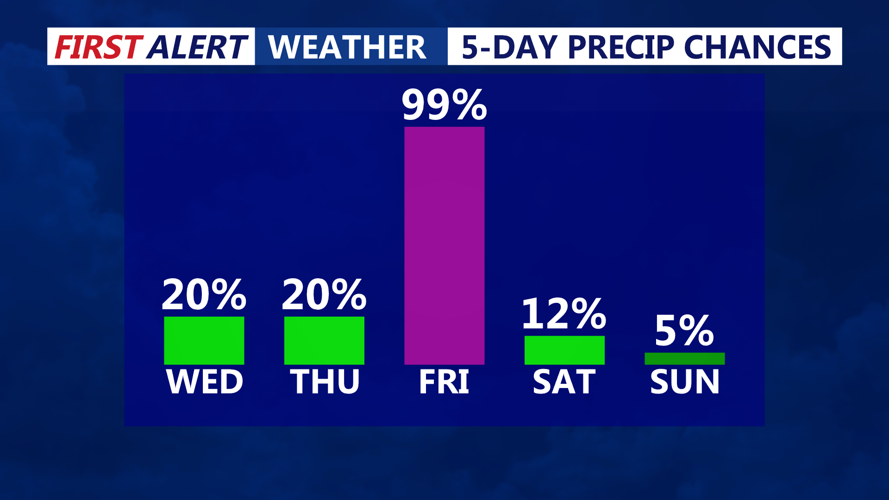
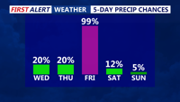

DELMARVA - A stretch of unusually mild November weather will continue across Sussex County through Wednesday, with temperatures climbing into the 70s before a slow-moving cold front brings an increasing threat of heavy rain late Thursday into Friday.
High pressure offshore continues to deliver warm southwesterly winds across southern Delaware, keeping conditions generally dry and pleasant. Communities from Georgetown and Seaford to Lewes, Rehoboth Beach, Bethany Beach and Fenwick Island can expect another quiet evening Tuesday, followed by the possibility of patchy fog developing overnight into early Wednesday.
Although widespread dense fog is not anticipated, some locations could experience reduced visibility during the Wednesday morning commute. Any fog that develops should dissipate by approximately 9 or 10 a.m., allowing sunshine and unusually warm temperatures to dominate the remainder of the day.
Wednesday afternoon highs are expected to reach the 70s across much of Sussex County, continuing a stretch of above-normal temperatures for early November. Southerly to southwesterly winds will generally remain light, with no significant weather hazards expected through Wednesday evening.
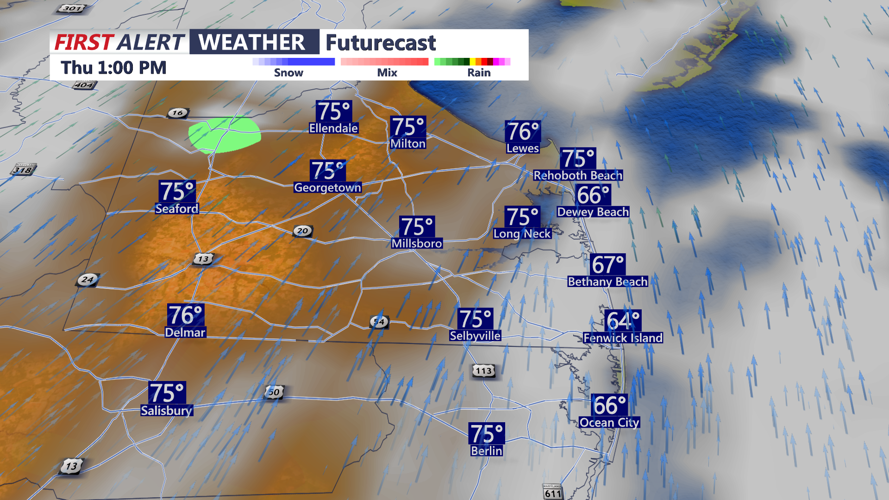
Attention then turns to an approaching cold front that will gradually slow as it reaches the Mid-Atlantic region Thursday night. While a few showers could develop Thursday, much of Sussex County and the Delaware beaches should remain mainly dry during the day.
Conditions are expected to change Thursday night into Friday as the front stalls near the region and an area of low pressure potentially develops along the boundary. Increasing Atlantic moisture could support periods of moderate to heavy rainfall, particularly across areas south and east of the Interstate 95 corridor.
Sussex County and coastal communities extending from Prime Hook through Rehoboth Beach, Bethany Beach and Fenwick Island could experience periods of heavier rain Friday, although the precise location and intensity of the rainfall remain uncertain.
The greatest concern will be where the front stalls and how quickly the developing low-pressure system moves northeast. A slower-moving front would increase the potential for prolonged rainfall and localized flooding concerns, especially in areas with poor drainage. A faster-moving system would reduce rainfall amounts.
Rain chances are expected to decrease heading into the weekend as high pressure attempts to build from the west. However, lingering atmospheric disturbances could keep occasional showers in the forecast through portions of the weekend and into early next week.
Marine conditions will remain relatively quiet through Wednesday, with southerly winds near 10 to 12 mph and seas of 1 to 2 feet. Conditions could deteriorate Thursday night into the weekend, with seas building to 3 to 5 feet and periods of Small Craft Advisory conditions possible.
For now, residents and visitors across Sussex County can enjoy another pleasant November day Wednesday while keeping an eye on the developing potential for heavy rainfall Friday.
