


DELMARVA - A warm and unsettled weather pattern will linger over Sussex County and the Atlantic beaches of the Delmarva Peninsula through late Thursday night before improving conditions arrive Friday.
A stationary front parked over the region Wednesday will lift north as a warm front overnight, keeping the air muggy and prompting scattered showers and thunderstorms into early Thursday. Patchy fog is also possible near the front, with overnight lows in the mid-60s to low 70s.
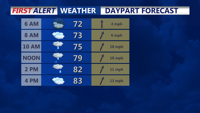
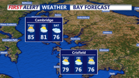
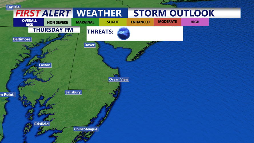
Thursday will bring seasonably warm, humid air with more showers in the morning and the potential for stronger storms in the afternoon and evening as a cold front approaches. Highs will range from the upper 70s to mid-80s, depending on how much sunshine breaks through the cloud cover. The Storm Prediction Center has placed the area under a marginal risk for severe weather Thursday, with damaging wind gusts the primary threat and a low but conditional risk for an isolated tornado. Rainfall totals could reach 1 to 2 inches, with locally higher amounts possible.
By Friday, the cold front will push offshore, bringing drier air and more comfortable conditions to most of the region. While a few lingering showers may brush coastal areas early, high pressure building from the west should produce a largely dry day with highs near the lower 80s.
Heading into the weekend, forecasters expect only scattered light showers as a weak surface trough lingers offshore. Heavy rainfall is not anticipated at this time, and more stable conditions should prevail through early next week as high pressure holds over the Mid-Atlantic.