


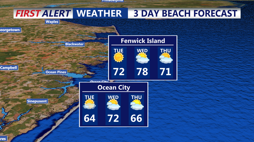

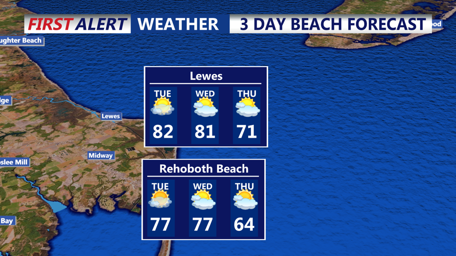

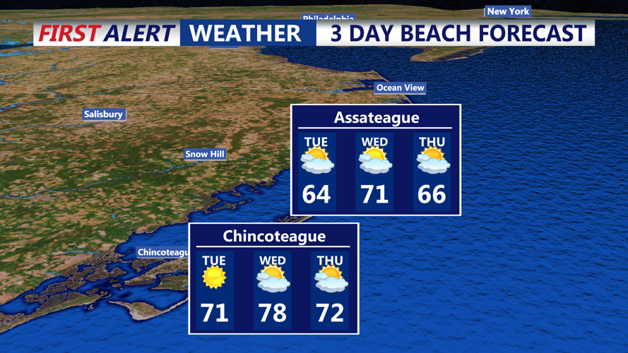

DELMARVA - Tuesday will start off warm and breezy across Sussex County’s beaches, as high pressure moves offshore and a warm front lifts north of the region. Morning temperatures will quickly rise, leading to daytime highs in the upper 70s to near 80 degrees inland, with coastal areas seeing slightly cooler conditions thanks to an onshore influence.
Southwest winds will strengthen during the day, reaching speeds between 15 and 20 mph with gusts up to 30 mph by the afternoon. Skies will remain partly sunny for much of the day, though increasing cloud cover is expected later as a cold front approaches from the northwest.
Showers and isolated thunderstorms are likely to arrive Tuesday evening into the overnight hours. However, most storms will be weakening as they approach the coast, with only light to moderate showers expected across the beach communities.
By early Wednesday, the cold front will slide across the region. Behind it, a brief period of offshore flow will keep temperatures mild during the day, with highs reaching the upper 70s across southern Delaware. While the Poconos and northern areas will cool more quickly, coastal Sussex County will experience one more warm day before cooler air arrives.
Wednesday night into early Thursday will bring noticeably cooler and drier conditions. With clearing skies and radiational cooling, overnight lows will fall into the mid-40s to low 50s near the beaches. Inland spots could drop even lower.
Thursday will begin under mostly sunny skies, although clouds may start increasing by late afternoon as the next system approaches from the west. High temperatures Thursday are expected to remain comfortable, topping out in the low to mid-70s along the coast.