




DELMARVA - Hazardous coastal weather will intensify Wednesday and continue into early Thursday, with the greatest impacts expected along the Atlantic-facing beach communities.
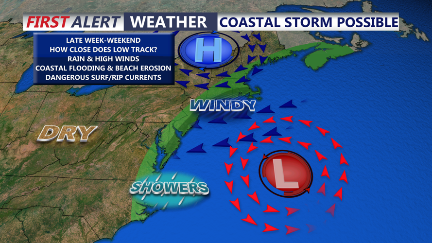
Any lingering showers across Delmarva early Wednesday morning should gradually diminish as drier air pushes south. Most of Wednesday is expected to be mainly dry, but a strengthening low-pressure system offshore will tighten the pressure gradient and increase northeast winds near the coast.
A Wind Advisory is in effect for the beaches from 6 a.m. Wednesday until midnight Wednesday night. Sustained winds of 25 to 35 mph are expected along the immediate Atlantic coast, with gusts near 45 mph possible. For residents and visitors, that means loose outdoor objects could be blown around, driving may become difficult at times and scattered tree limbs could come down.
A Coastal Flood Warning is also in effect for beginning Wednesday afternoon and continuing into early Friday. Persistent northeast winds will push water into tidal waterways, bays and back bays, leading to moderate tidal flooding in some locations. Low-lying roads, parking lots and properties near the water could take on water during high tide cycles.
The flood threat is being enhanced by higher astronomical tides ahead of Saturday’s full moon. The combination of persistent onshore flow and higher tides could keep water levels elevated through multiple tide cycles.
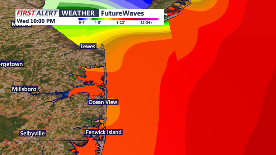
Beach conditions from Rehoboth Beach south through Dewey Beach, Bethany Beach and Fenwick Island will be especially dangerous. A High Surf Advisory remains in effect, with breaking waves expected to reach 6 to 12 feet. Those waves can cause significant beach erosion and make walking near the surf zone dangerous.
A High Risk for Rip Currents also remains in effect along the Atlantic beaches through Friday afternoon. This means life-threatening rip currents are expected, and swimmers can be pulled away from shore very quickly. Entering the ocean is strongly discouraged while the high-risk designation remains in effect.
Marine conditions will also deteriorate significantly. Gale Warnings are in effect for Delaware Bay and the Atlantic coastal waters, with northeast winds strengthening through Wednesday and gusts up to about 40 knots possible offshore. Seas are expected to build to 8 to 15 feet. For the average boater, a Gale Warning means conditions can become dangerous even for larger vessels, and small craft should remain in port.
By Wednesday night into early Thursday, rain should remain limited, but gusty northeast winds, rough surf and elevated tidal water will continue to affect coastal communities. The strongest impacts will remain focused near the Atlantic beaches and tidal back bays.
