


DELMARVA - A strong cold front will move into Sussex County late Wednesday, bringing the chance for strong to severe thunderstorms before a cooler, unsettled pattern settles over the Delaware coast.
The main window for storms is expected from late afternoon through mid-evening, with the strongest cells capable of producing damaging wind gusts. The National Weather Service has placed the area under a Severe Thunderstorm Watch until 9 p.m., and much of the region is in a level 2 out of 5 risk for severe storms.
The biggest concern is downburst winds, which can develop when strong thunderstorms push air rapidly toward the ground. Some storms could also produce hail, heavy rain and frequent lightning.
Rainfall totals will generally range from one-tenth to one-half inch, though heavier amounts are possible where stronger storms pass. Any thunderstorms should end late Wednesday evening, but showers may linger behind the front.
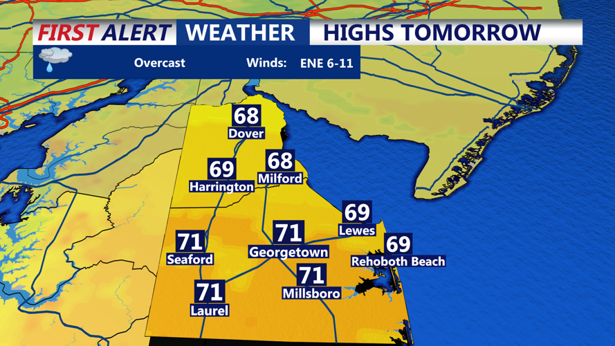
By Thursday, Sussex County will feel noticeably different. Highs near the coast are expected to stay in the 60s, with cloudy skies and additional showers or a thunderstorm possible during the afternoon.
The cooler, wetter pattern is expected to continue into the end of the week and the holiday weekend as the front stalls near or south of Delmarva. While the timing is not ideal for outdoor plans, the rain will be welcome as long-term drought conditions continue across the region.
