





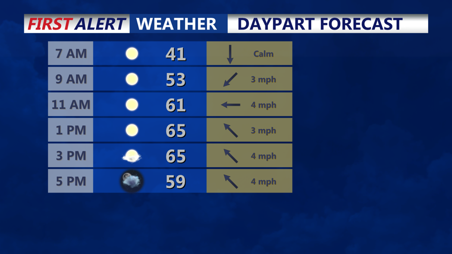
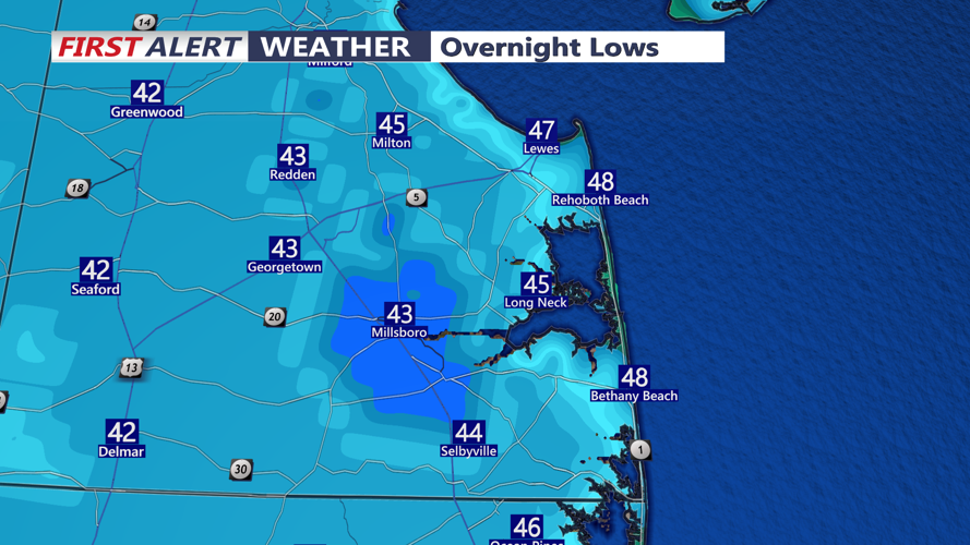

DELMARVA - Tranquil weather will continue across Sussex County late Tuesday evening through Wednesday evening, with clear skies, lighter winds and chilly overnight temperatures setting the stage for patchy frost before a significant change in the weather arrives later in the week.
High pressure building eastward will allow winds to diminish Tuesday night, creating favorable conditions for overnight cooling. Temperatures are expected to fall into the mid-30s across inland communities, including Georgetown, Seaford, Laurel and Millsboro, while coastal locations from Lewes and Rehoboth Beach south to Fenwick Island should remain somewhat milder, with lows generally in the upper 30s to lower 40s.
Patchy frost will be possible in sheltered inland areas early Wednesday morning, particularly where winds become calm. Residents with sensitive outdoor plants should consider taking precautions against the chilly conditions.
Wednesday will bring another pleasant November day, with a mixture of sunshine and occasional clouds and afternoon highs generally reaching the upper 50s to lower 60s. Winds will remain relatively light as high pressure gradually moves offshore.
However, conditions will begin changing Thursday as a strengthening storm system develops near the northern Mid-Atlantic coast. Low pressure is expected to consolidate near the New Jersey coastline before intensifying and tracking northeastward toward the Canadian Maritimes Friday into Saturday.
For Sussex County, the system will bring increasing clouds Thursday, followed by periods of rain Thursday into Friday. Rainfall amounts remain uncertain and will depend on the storm's eventual track. A farther northward track could limit precipitation across southern Delaware, while a more favorable storm position could produce a longer period of rainfall.
Coastal communities from Prime Hook and Lewes south through Rehoboth Beach, Bethany Beach and Fenwick Island should also monitor the potential for gusty winds and elevated tides. Minor tidal flooding cannot be ruled out, particularly around vulnerable back bays and low-lying coastal roads, although the extent of any flooding remains uncertain.
As the storm strengthens and moves away Friday, winds will shift to the northwest, allowing a much colder air mass to sweep across Delmarva.
Temperatures Friday and Saturday are expected to struggle through the 40s, with overnight readings dropping into the 20s and lower 30s across much of Sussex County. The combination of colder temperatures and gusty northwest winds will make conditions feel considerably colder.
Saturday could be particularly blustery, with wind gusts approaching 35 mph. Gusty conditions will continue Sunday, although wind speeds should gradually decrease.
Despite the approaching storm and colder temperatures, snow is not expected across Sussex County with this system. Any potential wintry precipitation should remain confined mainly to higher elevations well northwest of Delmarva, particularly the southern Poconos.
Some improvement is expected Sunday into Monday as temperatures begin a gradual recovery. However, afternoon highs will likely remain in the upper 40s to lower 50s, keeping the region below seasonal averages.
For residents and visitors along Delaware's beaches, Wednesday offers the best opportunity for outdoor activities before several days of unsettled, windy and increasingly cold November weather arrive.
