




DELMAVA - The National Weather Service has issued a Cold Weather Advisory for inland and coastal Sussex County as well as cities east of U.S. Highway 113, including Ocean City. Temperatures are expected to fall into the teens overnight, with wind chill values dropping into the single digits. Winds from the northwest will gust up to 30 mph, making it feel significantly colder and posing risks for frostbite and hypothermia for those exposed to the cold for extended periods.
Residents are urged to dress in multiple layers, cover exposed skin, and avoid prolonged outdoor activities during the coldest hours.
Freeze Spray Advisory Along the Sussex Coast
Mariners off the Sussex County coastline are under a Freeze Spray Advisory through Wednesday morning. The combination of gusty northwest winds and temperatures in the teens is creating conditions conducive to freezing spray. This phenomenon occurs when seawater, stirred by high winds and waves, freezes on contact with surfaces like boats or marine structures. The buildup of ice can add weight and destabilize vessels, posing a significant hazard.
Small craft operators are advised to remain in port or exercise extreme caution. Larger vessels should prepare for ice accretion and maintain readiness to adjust course or speed to minimize spray exposure.
Gale Warning in Effect for Coastal Waters
A Gale Warning remains active for coastal waters from Fenwick Island south through Ocean City and beyond. Northwest winds of 20-30 knots, with occasional gusts exceeding 40 knots, are expected to create hazardous marine conditions. Waves in the warning area could reach 6-9 feet, particularly during peak gust periods.
The Gale Warning highlights the dangers of attempting to navigate under these conditions, including the risk of capsizing and mechanical failure due to wave impact. Mariners are urged to stay in port until the advisory expires.
What to Expect Tuesday Night and Wednesday
The arctic cold front currently gripping the region will maintain its hold through Wednesday. As a weak shortwave aloft moves through the Mid-Atlantic Tuesday evening, mid- to low-level clouds will increase briefly, bringing the chance of isolated flurries to the area. No snow accumulation is expected due to the dry nature of the atmosphere.
Temperatures will plummet overnight, with inland Sussex and coastal areas dipping into the teens and low 20s. Strong winds will persist, keeping wind chills in the single digits through the early morning hours. These conditions fall short of reaching cold weather hazard thresholds but remain dangerously cold for vulnerable populations.
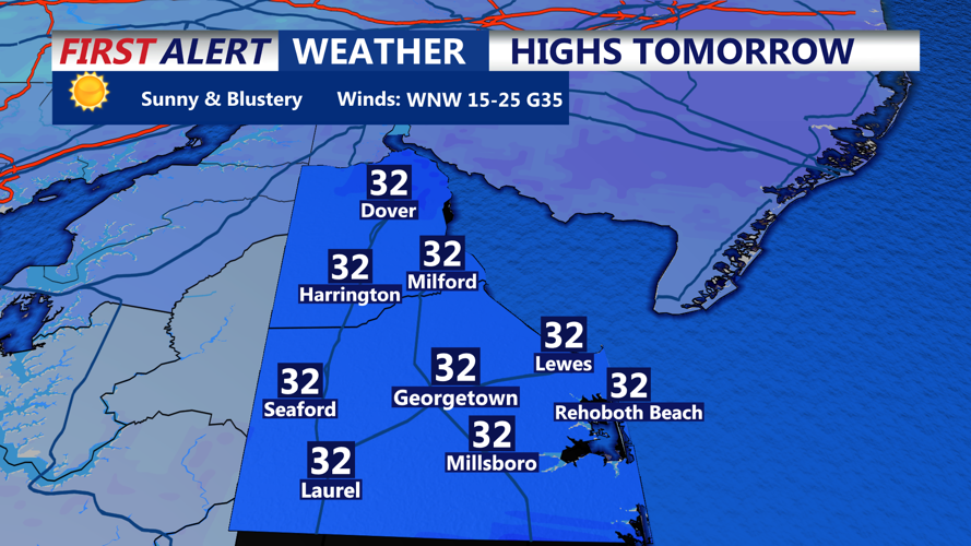
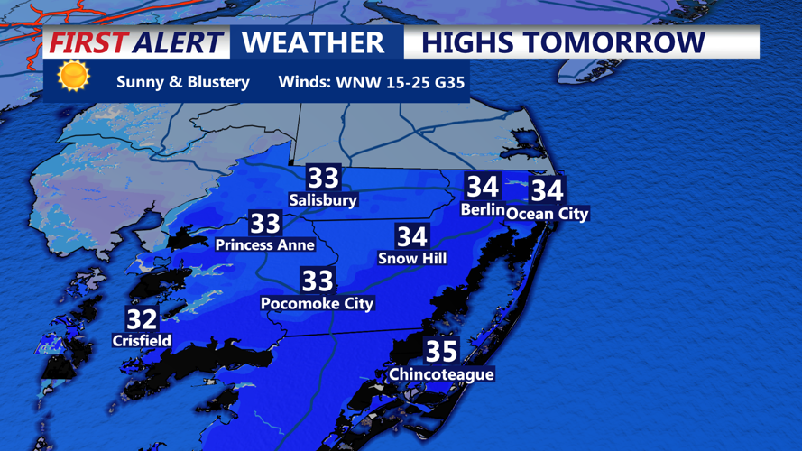
By Wednesday, skies will clear, leaving mostly sunny conditions throughout the day. However, the frigid temperatures will persist, with highs ranging from the upper 20s to mid-30s. Winds will remain brisk, maintaining the chill and making outdoor activities uncomfortable.
Safety Reminders for Residents and Visitors
- Inland Sussex County and Ocean City residents should monitor wind chill values and take precautions to protect themselves and pets from the cold.
- Mariners are strongly encouraged to heed Freeze Spray and Gale Warnings by avoiding unnecessary travel in affected waters.
- Commuters should prepare for gusty winds, particularly on elevated roadways and bridges.
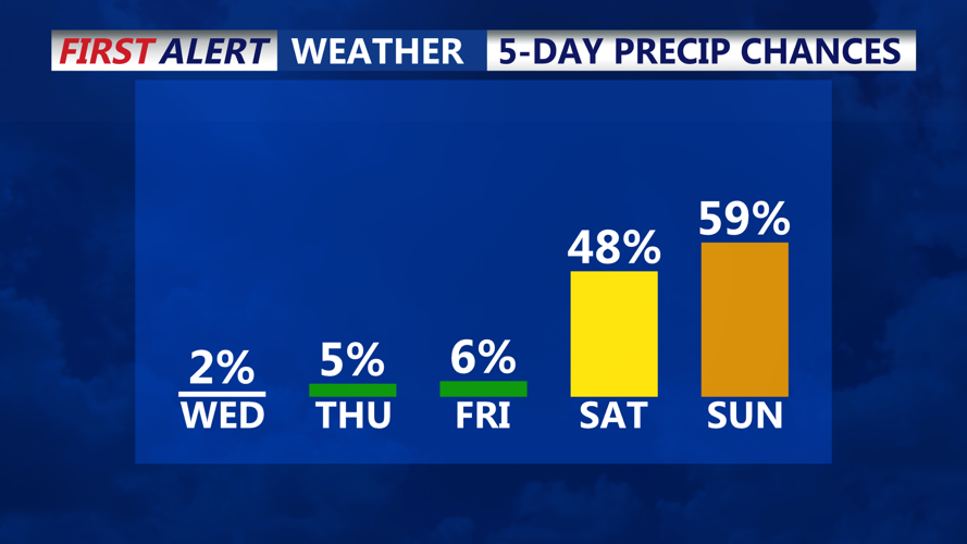
As the cold front remains in place, conditions are expected to moderate slightly by Friday, with a brief warm-up and clearer skies. Until then, Sussex County and nearby coastal Maryland areas remain under the influence of this arctic blast.
