


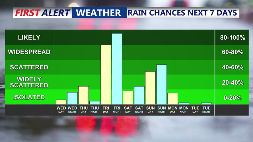


DELMARVA - A cold front moving offshore late Tuesday evening will bring increasing winds to Sussex County, particularly for beach and coastal towns along Route 1, before conditions turn quieter through Wednesday evening.
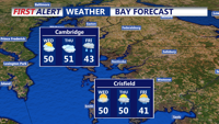
Overnight lows are expected to fall into the mid to upper 30s across coastal Sussex County, staying above freezing. That should limit any refreezing concerns, with icy spots mainly confined to untreated roads well north of the region. As the front passes, winds will strengthen, helping to dry out roads and lingering moisture.
Along the coast, wind gusts are forecast to range from 25 to 35 mph late Tuesday night into Wednesday morning. While stronger gusts of 40 to 50 mph are expected in the Poconos and higher elevations well inland, no widespread advisory-level winds are anticipated for Delaware’s beaches or Route 1 communities.
By Wednesday, high pressure building in from the west will bring mostly clear skies for much of the day. High temperatures are expected to reach the low to mid 40s near the coast. Winds will gradually ease through the afternoon, becoming lighter by Wednesday evening, with gusts dropping to around 5 to 10 mph.
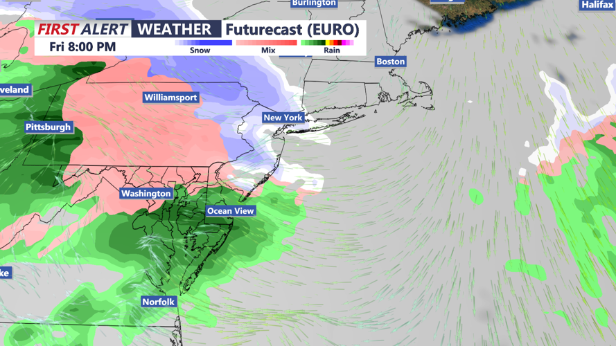
Clouds are expected to increase again late Wednesday evening as the next system approaches, but dry conditions are expected through the end of the day.