


DELMARVA - Sussex County residents can expect a chilly but calm night as high pressure builds across the region. The pressure gradient will relax overnight, causing winds to diminish to around 5 to 8 mph or less. Under clear skies, temperatures will plummet, with lows ranging from the upper teens to the low 20s, slightly warmer near the coast and urban areas.
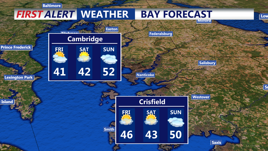
By early Friday morning, the calm winds and cold temperatures will linger, creating frosty conditions across the county. As the day progresses, strong high pressure centered near western Pennsylvania will dominate, ensuring clear skies and lighter winds from the northwest at 5 to 10 mph. Despite the sunshine, daytime highs will remain cold, reaching only the upper 30s inland and the low 40s closer to the southern coast of Delmarva.
Friday evening will bring another round of frigid temperatures as the high-pressure system strengthens further. Winds will calm significantly, creating conditions conducive to rapid cooling overnight.
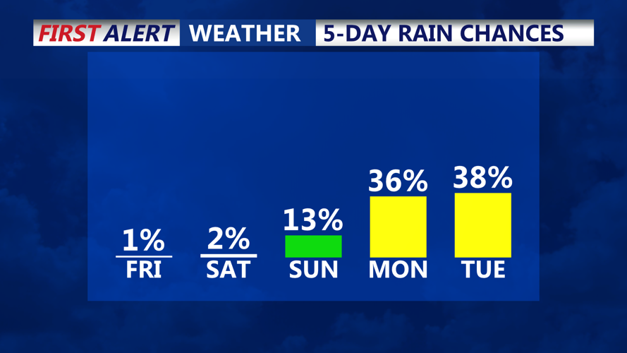
Looking ahead to the weekend, the cold pattern will persist under the influence of a strong surface high-pressure system, which could peak at an impressive 1,050 millibars. This setup will keep temperatures well below average, with increasing clouds expected Saturday night into Sunday as moisture from an upper-level trough approaches. Precipitation chances will rise late Sunday, potentially bringing the next weather system to the region.
For now, Sussex County should prepare for a cold and quiet end to the workweek, with sunshine providing little relief from the chill.