


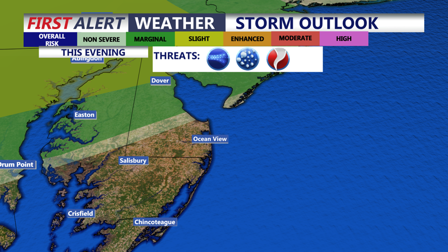


DELMARVA - Rain and a few thunderstorms will remain the main story late Wednesday evening along the coast, but the bigger change arrives early Thursday as a strong cold front sweeps offshore and sends temperatures falling through the day.
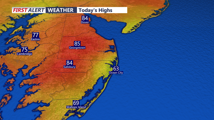
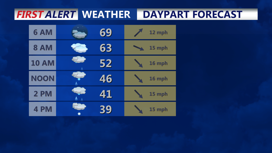
For the Sussex County beaches and Ocean City, the forecast points to periods of rain late Wednesday evening, followed by occasional showers overnight into early Thursday morning. Temperatures will stay unusually mild at first, then drop quickly around daybreak and through Thursday morning as colder air rushes in behind the front.
The key forecast question is whether rain briefly changes to snow before ending Thursday. Current guidance suggests that any changeover would come after the cold front passes, most likely from late Thursday morning into early Thursday afternoon at the beaches and in Ocean City. Even then, forecasters indicate the setup may be too dry for much more than scattered wet flakes or a short rain-snow mix before precipitation tapers off from west to east.
That means rain is expected to dominate for most of the event, with only a limited window for a brief change to wet snow Thursday before conditions dry out later in the afternoon and by Thursday evening. No snow accumulation is expected because ground and air temperatures will remain above freezing for much of the event.
Winds will add to the abrupt change. Northwest gusts of 30 to 40 mph are expected Thursday, especially from morning into midafternoon, making it feel much colder as temperatures slide from the 50s into the 40s.
The result will be a sharp turnaround from Wednesday’s warm, humid conditions to a raw and much colder Thursday evening along the Delaware and Maryland coast.
