


DELMARVA - Residents and visitors heading to Delaware's beach towns and Ocean City, Maryland, should prepare for cooler, damp conditions as we head into the weekend.
A cold front that pushed through the region earlier is now lingering just south of Delmarva, setting up a period of unsettled weather. High pressure building over New England will enhance an onshore flow beginning Friday night, drawing moist, cool air in from the Atlantic.
Friday Night:
Expect overcast skies with increasing humidity and the chance of scattered showers, especially inland and to the north. The easterly winds will pull in chilly ocean air, dropping temperatures into the upper 40s and low 50s across the coastal towns. Fog may develop overnight, especially inland, reducing visibility into early Saturday.
Saturday:
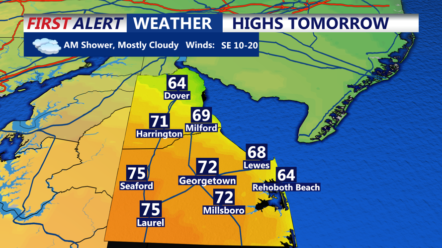
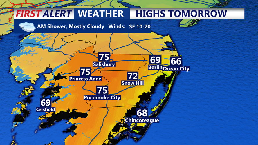
The stalled front begins to lift north as a warm front, though its progress may stall near southern Delmarva. This means Sussex County and Ocean City will remain on the cooler side, with daytime highs reaching only the upper 60s to low 70s — roughly five degrees below normal. Cloud cover is expected to persist with the chance of occasional light showers, although heavier rain will likely remain north and west of the beach areas.
Travelers and beachgoers should note:
The cool and damp conditions could impact outdoor plans.
Fog may affect visibility for drivers, particularly during early morning and late evening hours.
While not a washout, bring a rain jacket or umbrella just in case.
As we move toward Sunday, the region will see more defined frontal activity and a return to warmer temperatures before another cold front brings cooler air back into the region early next week.