


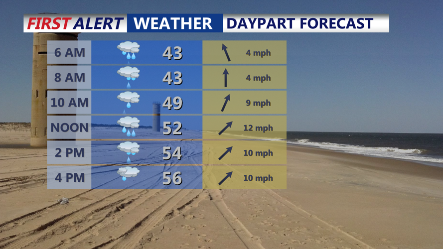

DELMARVA - If you’ve got outdoor plans Friday, you’ll want to keep an umbrella handy. A low-pressure system moving in from the Tennessee Valley will bring steady rain throughout the day. Showers will start early in the morning and continue through the afternoon before tapering off in the evening.
Temperatures will be relatively mild, climbing into the mid-to-upper 50s. Winds will shift from the southeast to the southwest as the system moves through, with occasional gusts making it feel a bit cooler. By late evening, drier air will start to filter in as high pressure begins to build. Overnight temperatures will drop into the mid-30s, so bundle up if you're heading out late.
Saturday: Sunshine Returns, But It’ll Feel Cold
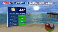
After Friday’s rain, Saturday will feel like a completely different season. Expect plenty of sunshine, but don’t let that fool you—it will be noticeably colder. High temperatures will only reach the low-to-mid 40s, and with a light northwest breeze, it’ll feel even chillier.
Saturday night will be the coldest of the weekend, with lows dipping into the 20s across Sussex County and the Ocean City area. If you're heading out early Sunday morning, you’ll definitely need a heavy coat.
Sunday: Clouds Increase, But It Stays Dry
Sunday will bring a mix of sun and clouds as a warm front lifts north. While skies won’t be as bright as Saturday, no rain is expected during the day. Temperatures will be slightly warmer, with highs in the mid-to-upper 40s.
Winds will shift again as the warm front moves in, setting the stage for a milder start to next week. Overnight lows will be a bit warmer than Saturday night, staying in the mid-to-upper 30s.
Looking Ahead: Warmer Weather Before the Next System
Early next week, temperatures will trend upward, with highs possibly reaching the 50s again by Monday. However, another storm system could bring more rain by the middle of the week. Stay tuned for updates as that system develops.