


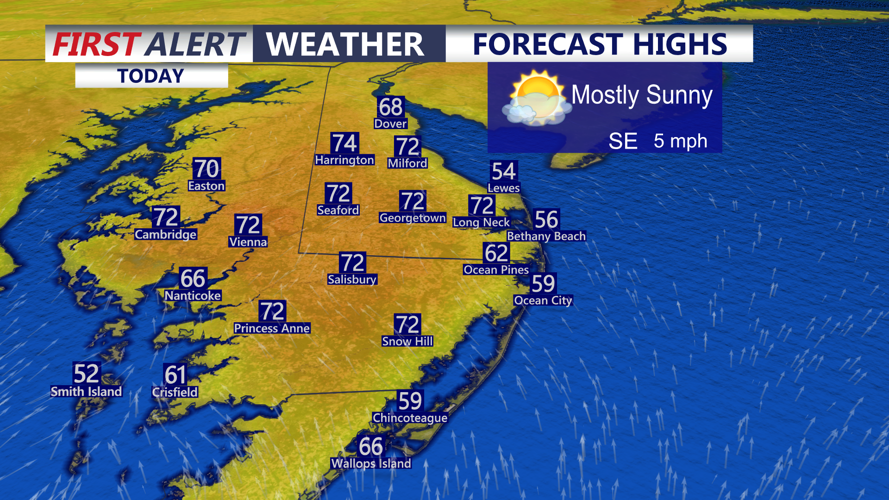


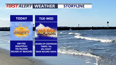
DELMARVA -- The peninsula will bask in sunshine and unseasonably warm temperatures as a strong area of high pressure over the western Atlantic continues to funnel mild air into the region. Inland communities will warm into the upper 60s and low 70s this afternoon, while locations along the Chesapeake Bay and at the beaches remain noticeably cooler, with highs in the 50s and 60s.

Warming into the low 70s away from the coast, cooler by the bay and ocean highs in the 50s and 60s.
Tonight, mainly clear skies will allow more fog to develop across parts of the peninsula. Overnight lows will settle into the upper 40s inland, with upper 40s to low 50s expected closer to the coast.

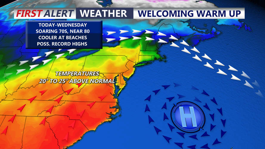
Near record highs Tuesday and Wednesday across inland areas of Delmarva.
The warmth builds even more through the middle of the week. Tuesday is shaping up to be a near-record warm day across Delmarva, with highs approaching 80 degrees away from the coast. Cooler marine air will keep temperatures in the 60s near the ocean and Bay. In Salisbury, the record high for Tuesday is 77 degrees, set in 2016, for Wednesday the record high is 76 set back in 2000. Wednesday stays very mild as well, with highs in the upper 70s. Georgetown’s record high for Tuesday is 80 set in 2006, Wednesday is 77 degrees, set in 2021. Record highs have a good chance of being broken in those locations over the next two days.
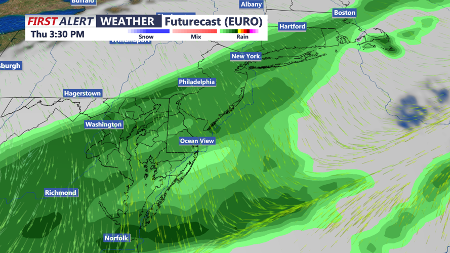
Changes arrive Thursday as a cold front moves toward the region. Scattered showers are expected, and a rumble of thunder cannot be ruled out. At this point, the greater severe weather threat appears likely to stay west of Delmarva, but the exact timing of the front will determine how the day plays out. Temperatures are expected to fall through the day as blustery and much cooler air rushes in behind the front.

Cold front pushes through Thursday bringing a chance for rain and a rumble of thunder.
