


DELMARVA - Coastal communities are under multiple watches and advisories as the region braces for the impacts of a low pressure system and Hurricane Erin, which will pass hundreds of miles offshore but still create significant hazards for coastal residents. The period from early Wednesday through early Friday is expected to bring showers, gusty winds, and the most serious marine and tidal impacts.
Watches, Warnings and Advisories
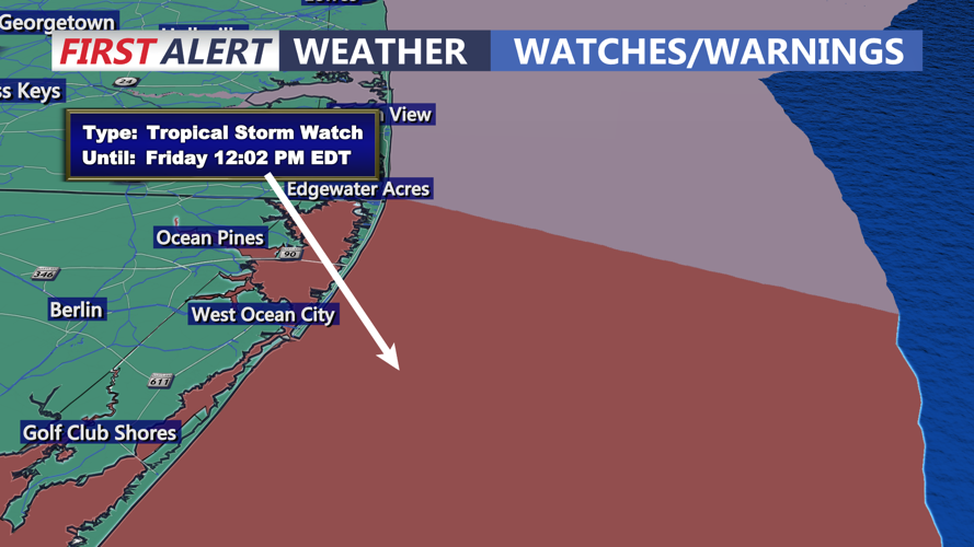
The National Weather Service has placed much of Sussex County, Wicomico County, and coastal Maryland and Virginia under a variety of warnings:
Coastal Flood Warnings and Advisories remain in effect, with the greatest concern centered around Thursday evening’s high tide, when widespread minor to moderate flooding is anticipated along back bays and low-lying communities.
High Surf Advisories are posted, warning of large breaking waves and life-threatening rip currents. Beach erosion is possible in Rehoboth, Bethany, Fenwick Island, Ocean City, and south toward Chincoteague.
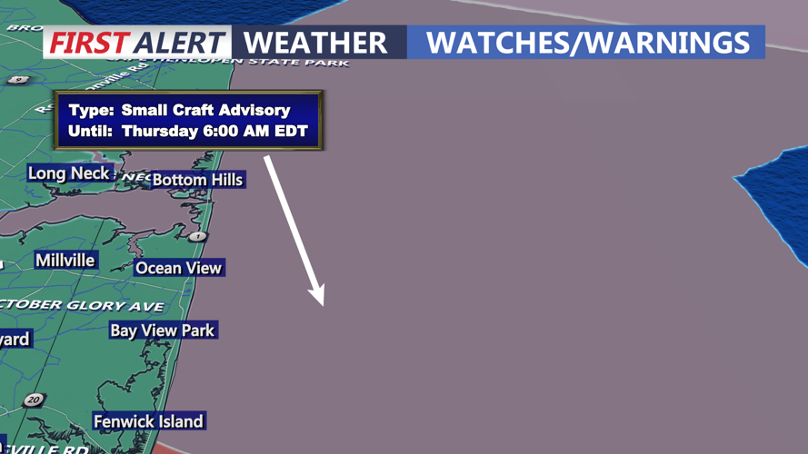
Small Craft Advisories and Gale Watches cover the coastal waters, with seas building and wind gusts nearing 40 mph during Erin’s closest pass.
Wind Advisories may be issued as coastal gusts push into the 30 to 40 mph range Thursday, while inland areas see sustained northeast winds in the teens to twenties.
Timeline of Impacts
Wednesday: Moisture from the Atlantic and a weak front combine to bring scattered showers and isolated thunderstorms across Delmarva. Skies will stay mostly cloudy, with highs in the upper 70s to low 80s. Winds from the east and southeast increase through the day.
Wednesday Night: Showers persist as Erin’s circulation draws moisture into the region. While inland rainfall amounts remain light, coastal areas will see strengthening onshore winds and rising seas.
Thursday: Erin makes its closest approach — 350 to 450 miles offshore — but its influence will be felt along the coast. Gusty winds, rough surf, and tidal flooding are expected to peak Thursday evening, with vulnerable roads and low-lying neighborhoods likely to see inundation. Rip currents will be life-threatening. Inland areas will see cooler conditions under mostly cloudy skies, with highs in the lower to mid-70s.
Early Friday: Erin pulls farther into the Atlantic, allowing skies to clear and winds to ease overnight. By daybreak, conditions will turn more favorable, though high surf and dangerous rip currents will linger. Friday is expected to bring sunshine, lighter winds, and highs returning to the upper 70s and low 80s.
Local officials are urging beachgoers and mariners to take precautions and to avoid entering the surf until conditions improve. Drivers in flood-prone areas are also reminded not to attempt to pass through water-covered roadways.