


DELMARVA - Residents and visitors along the coast should brace for unsettled weather late Wednesday through Friday as Hurricane Erin makes its closest pass offshore. While the storm will remain several hundred miles from the Delmarva beaches, its influence will be strongly felt.
Forecasters say a stalled frontal boundary will combine with Erin’s circulation to keep skies mostly cloudy and showers scattered through late Wednesday night. Downpours may lead to localized flooding in low-lying areas, especially where drainage is poor. Temperatures will hold in the 60s to near 70 along the coast.
By Thursday morning, Erin will be positioned well southeast of Cape May, N.J., but its expansive wind field will generate dangerous surf and life-threatening rip currents. Winds along the Delaware and Maryland beaches are expected to increase to 20 to 25 mph, with gusts reaching or exceeding 45 mph. The strongest winds will impact coastal communities such as Rehoboth Beach, Bethany Beach, Fenwick Island and Ocean City, Md.
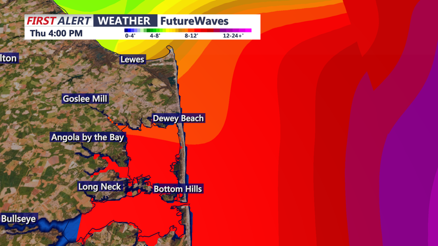
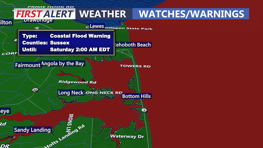
Coastal flooding and beach erosion remain significant concerns through Thursday, especially during high tides. Wave action and storm surge could undermine dunes and damage beach crossovers. The National Weather Service has issued advisories for hazardous marine conditions, with seas building to dangerous levels offshore.
Thursday night, skies will gradually clear as Erin accelerates farther into the Atlantic. However, north winds will remain gusty, with speeds of 20 to 30 mph and gusts around 50 mph lingering into the overnight hours.
By Friday, high pressure will begin to build across the Mid-Atlantic, allowing for drier air and more stable conditions. Winds will ease through the day, and temperatures are forecast to rebound into the upper 70s and low 80s inland, with mid-80s possible along the coast.
Beachgoers are urged to avoid swimming through the end of the week due to powerful rip currents and heavy surf. Local emergency management officials caution that even with Erin offshore, the combination of wind, tide and waves will continue to pose risks until the weekend.
Looking ahead, forecasters expect a stretch of fair weather to extend into Saturday before another cold front approaches early next week, bringing a chance for showers once again.