


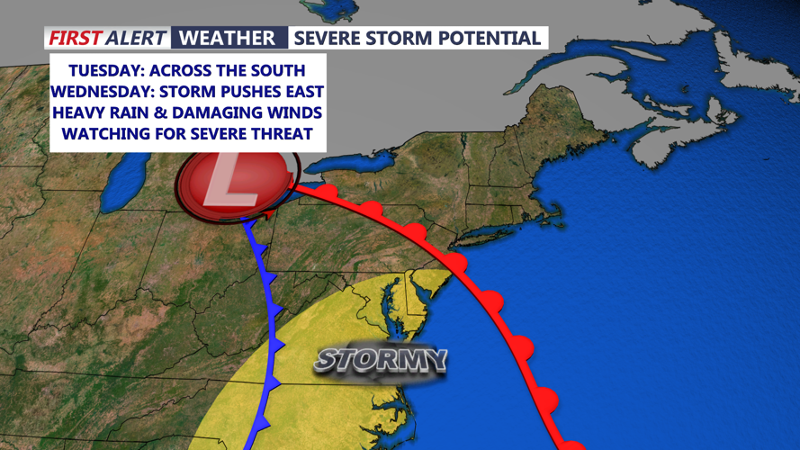

DELMARVA - A strong area of low pressure will approach from the west Tuesday night, intensifying as it tracks into the Great Lakes on Wednesday and southern Quebec by Thursday. A powerful cold front will push through the Mid-Atlantic region Wednesday night, bringing the most significant impacts to our area.
Timeline of the Storm
Late Tuesday Night into Wednesday Morning:
- Increasing cloud cover with a warm front lifting north, leading to much milder overnight temperatures in the 40s and 50s across southern Delaware.
- Isolated showers developing, mainly inland, with strengthening winds near the coast.
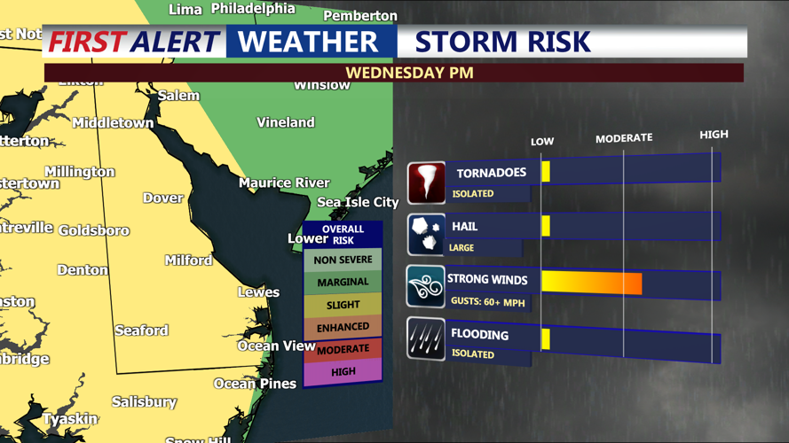
Wednesday Afternoon:
- Heavy rain and gusty winds intensify, with sustained winds of 20-30 mph and gusts over 45 mph, especially near the ocean.
- A squall line of thunderstorms is expected to move through, bringing the potential for damaging wind gusts and isolated tornadoes.
- Travel conditions will deteriorate, particularly during the afternoon and early evening hours.
Wednesday Night:
- The cold front will push eastward, but lingering showers and gusty winds will persist.
- Temperatures will drop into the 40s overnight as winds shift to the northwest.
Severe Threats and Safety Precautions
The primary concerns include:
- Damaging winds up to 50 mph, with the potential for power outages.
- Torrential rain leading to localized flooding, particularly in low-lying coastal areas.
- Isolated tornadoes embedded within the storm line.
How to Protect Yourself:
- Secure loose outdoor items like patio furniture and decorations.
- Charge devices and prepare for power outages in case of downed lines.
- Avoid travel during peak storm hours, especially in flood-prone areas.
- Stay informed by downloading the CoastTV Weather App for real-time alerts and updates.
As the storm moves out, Thursday will remain windy, with gusts still reaching 30-35 mph before calmer conditions return later in the week.
Stay weather-aware and take precautions ahead of this powerful system moving into Sussex County and Delaware’s coastal areas.