


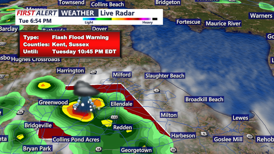


DELMARVA - The National Weather Service office in Mount Holly has issued an urgent Flash Flood Warning for northwestern Sussex County in southern Delaware and south central Kent County. The warning remains in effect until 10:45 p.m. EDT tonight.
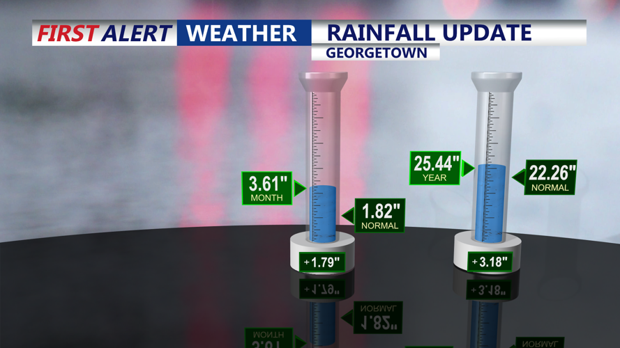
At 6:34 p.m., Doppler radar indicated slow-moving thunderstorms producing torrential rainfall across the warned area. Between 1.5 and 2.5 inches of rain have already fallen, with an additional 1.5 to 2.5 inches possible through the evening hours.
Hazard:
Flash flooding caused by thunderstorms.
Source:
Radar detection of heavy rainfall.
Impact:
Flooding is either ongoing or expected to begin shortly. Residents should be prepared for flooding of small creeks and streams, urban areas, highways, streets, underpasses, and other low-lying locations.
Locations at Risk:
Milford
Bridgeville
Ellendale
Greenwood
Farmington
Andrewsville
Numerous local waterways and drainage channels may rapidly overflow, including:
Cedar Creek, Mispillion River, Nanticoke River, Broadkill River, Jones Mill Branch, Parker Branch, Marshyhope Creek, Deep Creek, and multiple smaller tributaries.
Safety Information:
Turn around, don’t drown when encountering flooded roads. Most flood deaths occur in vehicles. Remain alert to rapidly rising water, especially after dark.
