


DELMARVA - Hurricane Erin will make its closest pass to the Delmarva region Thursday, remaining well offshore but producing widespread impacts along the beaches and waterways of Sussex County and Ocean City.
Thursday Morning: Cloudy skies and showers will linger along coastal Delaware and Maryland through the morning hours before tapering off from northwest to southeast. Winds will strengthen to 20 to 25 mph, with gusts topping 45 mph near the coast. These strong onshore winds will drive seas higher and fuel a heightened risk of coastal flooding during high tide cycles.
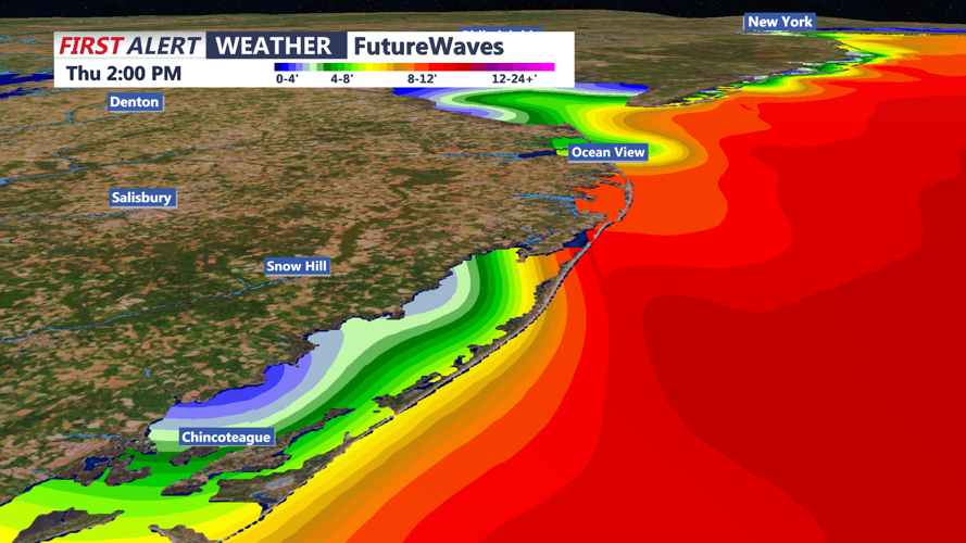
Thursday Afternoon into Night: As Erin continues northeastward into the Atlantic, clouds will gradually thin, but winds will remain a hazard. Gusts near 50 mph may continue along the barrier islands, with coastal advisories in effect. Rough surf, pounding waves, and life-threatening rip currents will persist throughout the day. Beach erosion is expected, particularly in exposed areas of Rehoboth Beach, Bethany Beach, Fenwick Island, and Ocean City. Temperatures will remain seasonable, with highs in the mid to upper 70s.
By Thursday night, conditions will slowly improve as Erin pulls farther away. Skies will partially clear, but north winds will continue blowing 20 to 30 mph, keeping coastal waters hazardous. Overnight lows will dip into the 60s across Delmarva, with lingering breezy conditions into early Friday.
Early Friday: Winds will gradually weaken through the morning as high pressure builds into the region. Drier air will return, setting the stage for improving weather to close out the week. Even as skies brighten, beachgoers are urged to stay out of the surf as rip currents and rough seas will remain dangerous.
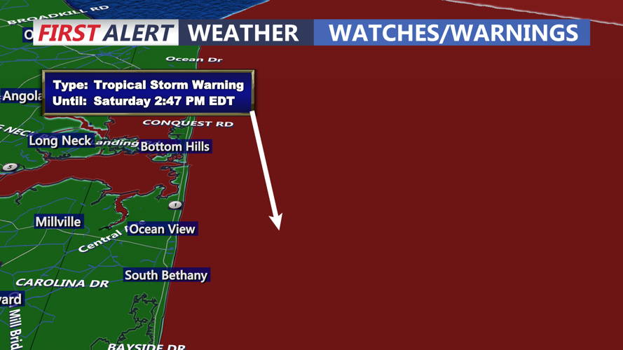
Local officials advise residents and visitors to secure loose outdoor items, use caution while driving near the coast, and avoid entering the ocean until advisories are lifted.