


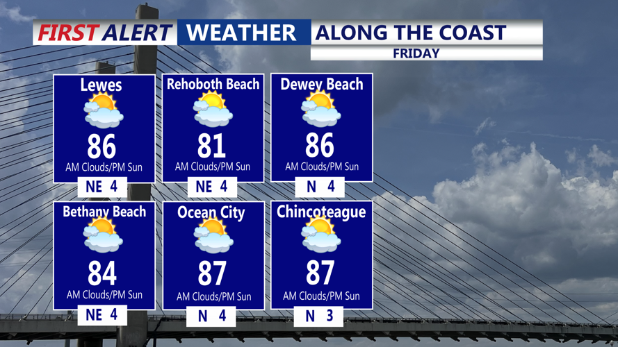


DELMARVA - Residents of Sussex County can expect a stretch of warm, muggy weather from early Friday through early Sunday morning, with isolated showers and thunderstorms mainly affecting inland areas.
Radar Thursday evening showed convective storms developing south and east of Philadelphia, where the greatest instability was present. These storms were expected to weaken after sunset as daytime heating diminished. Areas that received rainfall could see patchy fog forming overnight, while other locations will remain tranquil with scattered clouds.
Storm coverage on Friday will be much lower compared to Thursday, as upper-level forcing remains weak. However, isolated to widely scattered thunderstorms may develop during the afternoon and evening due to daytime heating. Temperatures will be oppressive, with heat indices ranging from the mid- to upper 90s.
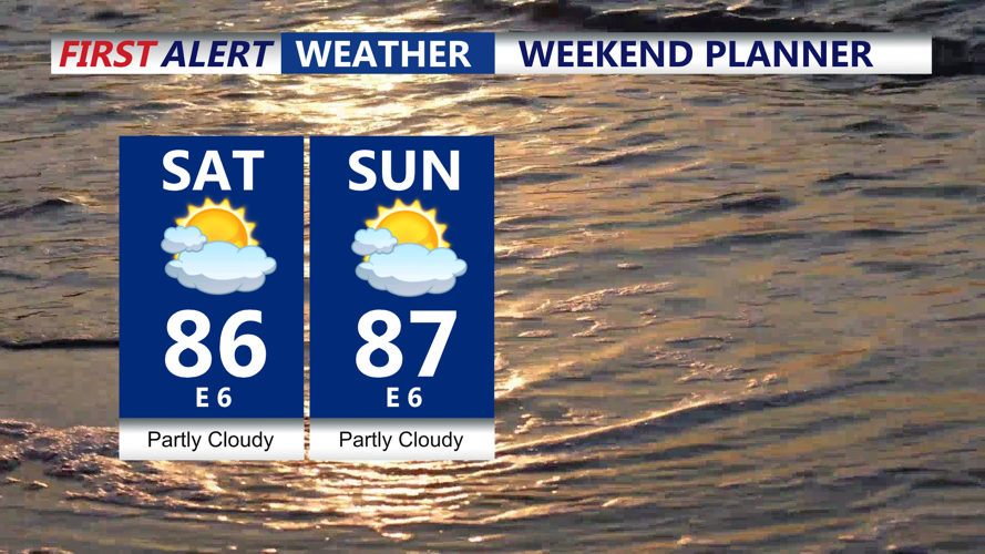
Friday night into Saturday, a stalled front will linger to the north and east of the area. Although forcing will remain limited, a stray shower or thunderstorm cannot be ruled out overnight. By Saturday, diurnal heating is expected to trigger scattered showers and thunderstorms, especially away from the cooling influence of the ocean. Highs will reach into the 80s across most inland communities.
On Sunday, a warm front will begin lifting into the region, sparking isolated showers and thunderstorms during the day. Most of the more widespread storm coverage is forecast to remain west of the county as a cold front remains stalled northwest of the area. Temperatures Sunday will again top out in the 80s, with continued humidity making conditions feel sticky and uncomfortable.
While much of the weekend will remain dry, any thunderstorms that form could produce locally heavy rainfall, gusty winds up to 40 knots, and brief reductions in visibility. Fog will be possible overnight in areas that pick up rain, especially in low-lying spots. Residents and visitors are encouraged to stay hydrated, limit strenuous outdoor activities during peak heating, and monitor local forecasts for any updates or advisories.