




DELMARVA - High pressure today will maintain tranquil weather across Sussex County, Delaware, and the Ocean City area. However, changes are on the horizon as a warm front moves through the region Saturday, bringing light rain and milder temperatures before a strong arctic cold front sweeps in Sunday, dramatically altering conditions.
Friday Late Evening
Clear skies and calm conditions will dominate late Friday evening, with temperatures dipping into the mid-20s to low 30s across Delmarva. Clouds will begin to build after midnight, setting the stage for Saturday’s warm front.
Saturday Morning
Saturday morning will bring overcast skies as the warm front approaches from the south. While most of Sussex County and Ocean City will experience light rain by mid-morning, far northern Delaware could see a brief window of freezing drizzle or light freezing rain around sunrise. This slight chance (20%) is conditional on localized moisture levels remaining below freezing for a short period.
Saturday Afternoon and Evening
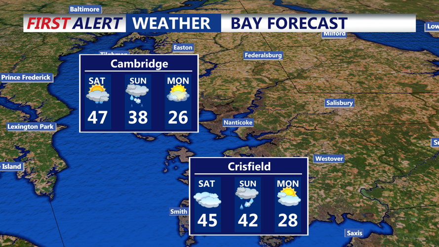
Light rain is expected across the region during the daytime hours, with precipitation amounts remaining minimal—generally only a few hundredths of an inch. Highs will climb into the 40s south and east of the fall line, offering a brief respite from the winter chill. Rain may linger along the coast into Saturday evening before tapering off.
Saturday night will feature mostly cloudy skies as another system begins to approach. Temperatures will hold steady, with lows ranging from the lower 20s inland to the lower 30s near the coast, as cloud cover prevents significant cooling.
Sunday Transition
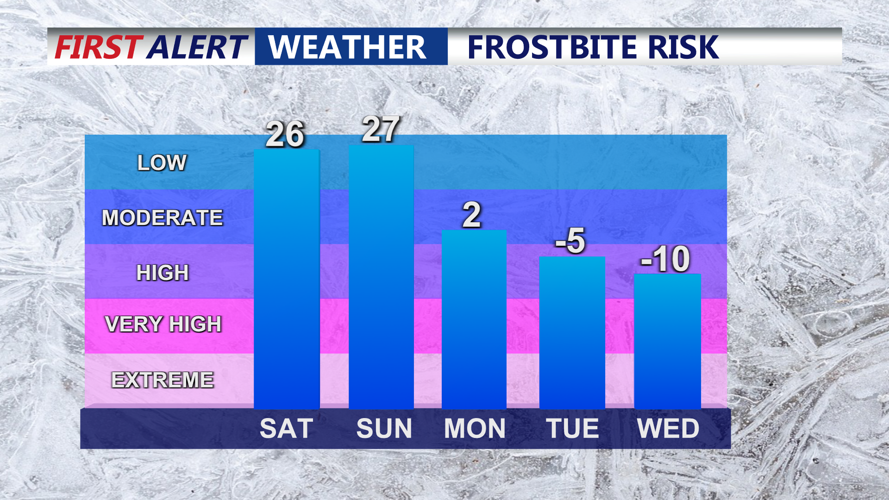
Sunday morning will mark the arrival of a powerful arctic cold front, bringing sharply colder air and gusty winds. Temperatures will drop steadily through the day, and snow is likely as a secondary low-pressure system develops along the Carolina coastline. Accumulating snow is expected Sunday night, with precise totals depending on the storm's track and intensity.
Outlook
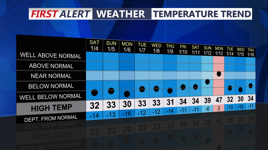
By Monday, an arctic high-pressure system will dominate, bringing frigid air and well-below-normal temperatures that could persist through the middle of the week.
