


DELMARVA -- As we turn the calendar to June and mark the first day of meteorological summer, we look back on a May that ended warmer and wetter than average.

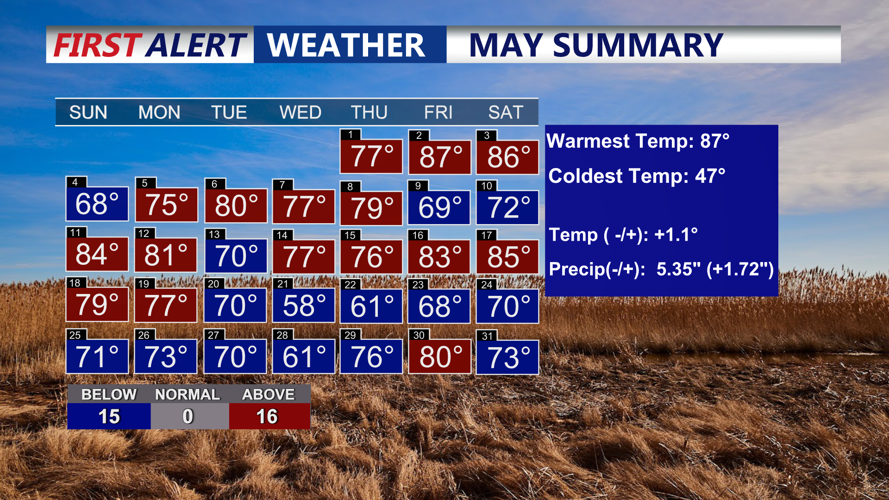
We ended May running +1.1 degree above normal for the month despite 11 of the last 12 days of the month being below average.
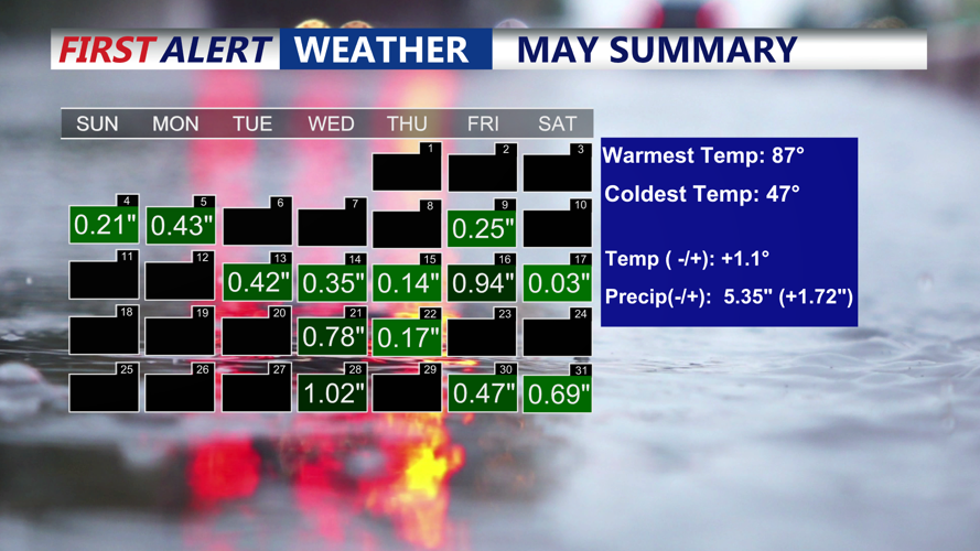
Georgetown recorded a high temperature of 87 degrees and dipped as low as 47 on two occasions. Despite 11 of the last 12 days of the month being below average, May still finished 1.1 degrees above normal overall. Rainfall totals reached 5.35 inches, putting the area 1.72 inches above the monthly average.

We ended the month with 5.35" of rain, so we were +1.72" above normal.
Sunday brought a taste of that lingering cool trend, with highs only reaching 70 degrees in Georgetown. Skies took on a hazy appearance, not from humidity but due to wildfire smoke drifting in from Canada. Fortunately, the smoke is staying high in the atmosphere, so air quality impacts are not expected. However, the haze may continue to be visible at times into early this week. A strong solar storm on Sunday is also increasing the chances for a rare glimpse of the Northern Lights Sunday night across parts of the Mid-Atlantic.
Looking ahead, Sunday night will be partly cloudy with lows in the low to mid-50s.

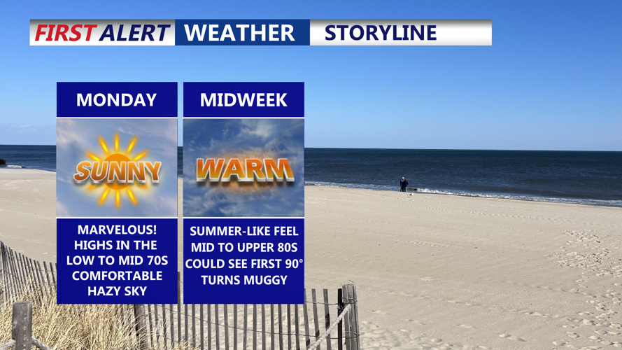
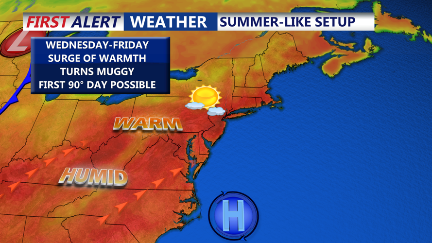
An absolutely beautiful start to the week, pleasant and comfortable, warmth and humidity build in mid to late week.
High pressure will begin to slide offshore, allowing a warming trend to take hold. Monday through Wednesday will bring mostly sunny skies, light northwest winds, and gradually increasing temperatures. Inland areas can expect highs in the low to mid-70s to start the week, with coastal regions staying slightly cooler.

The sky may look hazy at times to start the week, this is from Canadian wildfires, the smoke is high up in the atmosphere and won't pose any air quality threat.
By Tuesday, temperatures will approach the low 80s, and by Wednesday and Thursday, inland highs are forecast to climb into the mid to upper 80s. Thursday looks to be the warmest and driest day of the week, with some areas nearing 90 degrees under mostly sunny skies and lower humidity.

Bermuda high will help funnel in summer-like temperatures and humidity late week.
Changes arrive Friday and Saturday as upper-level disturbances move in from the Great Lakes, increasing the chance for showers and thunderstorms. While details are still uncertain, the trend points to a more unsettled pattern heading into the weekend. Despite the storm chances, temperatures will remain above average through the period.