


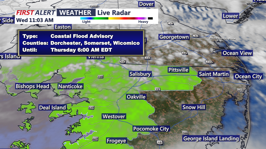


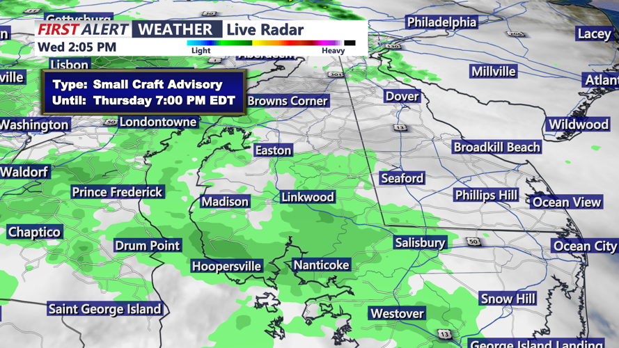

DELMARVA - Sussex County will see a damp and unsettled stretch late Wednesday evening as low pressure and its associated fronts cross the region. Showers will continue moving west to east through the evening, with a chance for an isolated thunderstorm as milder air briefly moves in ahead of the system.
Rainfall totals are expected to generally range from one-quarter to three-quarters of an inch, bringing much-needed rain to an area still dealing with longer-term dry conditions. Some heavier showers could briefly cause ponding on roads, especially in low-lying or poor-drainage areas.
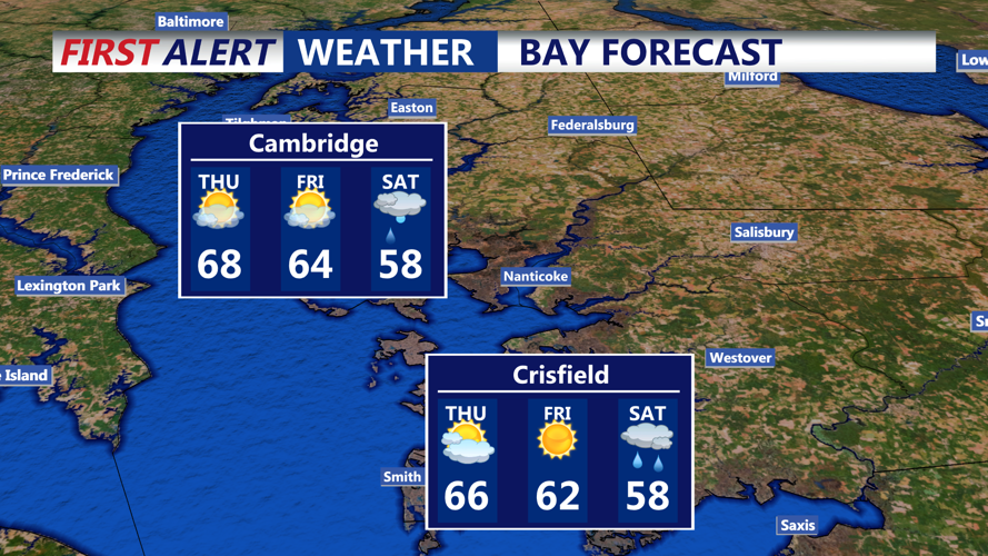
The showers will taper off overnight into early Thursday as the surface low and cold front clear the area. Behind the front, winds will turn out of the northwest and become gusty. Thursday will be mainly dry, with clouds giving way to improving conditions, but a brisk breeze will make it feel cooler at times.
By Thursday evening, Sussex County should remain dry with a continued northwest breeze and cooler temperatures settling in. Looking ahead, another storm system may track close to the region Saturday, bringing the next chance for rain and cooler-than-average weekend temperatures.
