


DELMARVA - A slow-moving cold front will bring unsettled weather to Sussex County late Friday evening through Saturday night, with showers, thunderstorms, and areas of dense fog in the forecast.
Scattered thunderstorms and rain showers began affecting parts of the Delmarva Peninsula Friday evening, with rainfall rates of 1 to 2 inches per hour prompting the National Weather Service to issue a Flash Flood Watch for the region until 10 p.m. While the risk for severe weather remains marginal, some storms could bring damaging winds and large hail to the area.
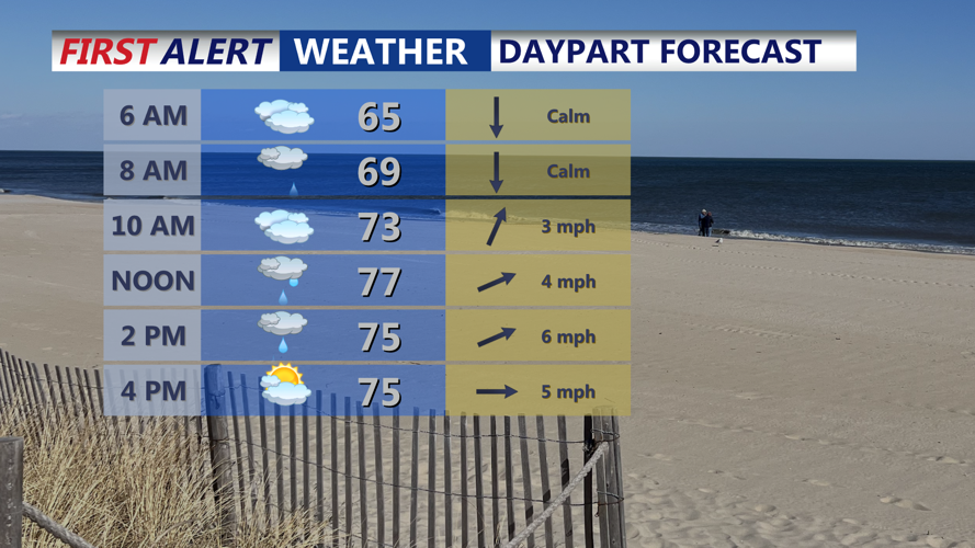
Overnight Friday into early Saturday, skies are expected to become partly cloudy, but humid conditions will allow fog and low clouds to develop, potentially reducing visibility into the morning hours. Temperatures will remain mild and sticky.
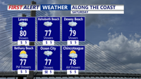
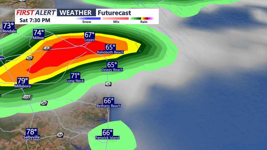
Saturday brings another chance for showers and thunderstorms, especially during the afternoon hours as the cold front continues its slow eastward push. While widespread severe weather is not expected, localized heavy rain and strong wind gusts remain possible. Visibility may dip during heavier rainfall or in areas of fog early in the day.
By Saturday night, most of the rain will taper off, particularly across northern areas, as weak high pressure builds in from the north. The risk for additional light showers may linger across southern and eastern portions of the county, but the trend will be toward drier conditions.
Looking ahead, Sunday will start mostly dry, but a warm front approaching from the south could bring another round of showers and thunderstorms late Sunday into Monday. The stormy pattern will continue through Tuesday before high pressure brings a return to fair weather by midweek.