


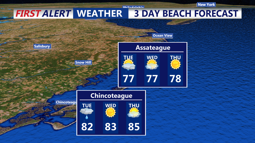
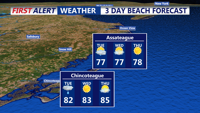
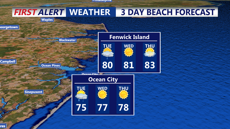


DELMARVA - Sussex County beach towns will face an active weather pattern early Tuesday, as a cold front pushes through the area, before tranquil and warmer weather arrives midweek.
Starting in the early morning hours Tuesday, around 2 to 4 a.m., showers will move into the region from the west. Periods of rain and embedded thunderstorms are expected throughout the morning, especially for communities east of Route 1, including Lewes, Rehoboth Beach, Dewey Beach, Bethany Beach and Fenwick Island.
Rain coverage will become more scattered during the late morning and early afternoon, though the potential for heavier downpours remains. The front will slow as it passes through the area, possibly stalling briefly near the coast. This raises concerns for localized flooding, especially in low-lying and poorly drained spots. The National Weather Service includes southern Delaware in a marginal risk category for excessive rainfall.
Instability is moderate but increasing, with some models showing the potential for stronger thunderstorms. While widespread severe weather is unlikely, an isolated storm could bring gusty winds or brief heavy rain. Afternoon highs will climb into the upper 70s to low 80s with humid conditions persisting through much of the day.
By Tuesday night, the front moves offshore, and skies begin to clear. Temperatures will dip into the upper 50s to low 60s along the beaches, bringing a refreshing change as drier air filters in.
Wednesday marks the start of a warming trend, fueled by high pressure settling to the south. Expect sunny skies with west to southwest breezes and highs reaching the low to mid-80s across Sussex County. Conditions will remain dry and pleasant into the night, with overnight lows in the mid to upper 60s—more typical of summer than early June.
By early Thursday morning, the region will wake to fair skies and mild temperatures, setting the tone for another warm day ahead. No precipitation is expected during this period.
This brief stretch of calm weather may be the best opportunity for beach outings before another cold front approaches Friday, setting up a return to unsettled conditions for the weekend.