


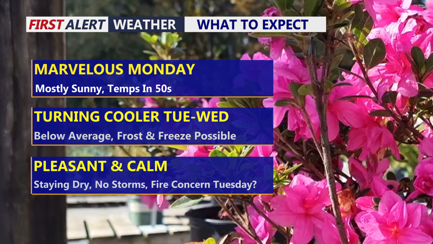
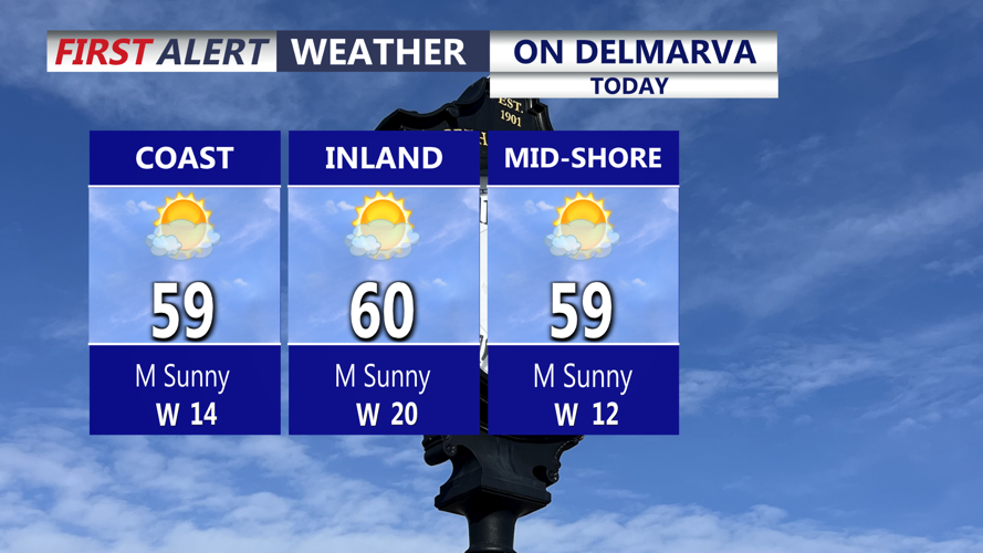


DELMARVA -- Plenty of sunshine will brighten Delmarva today, but a steady west-northwest breeze will keep the air feeling crisp. Afternoon temperatures will climb into the upper 50s to near 60 degrees, while wind gusts of 20 to 25 mph add an extra chill across the peninsula.

Mostly sunny skies and highs in the upper 50s to near 60 with winds out of the west gusting to 25 mph.
Tonight, skies turn partly cloudy with temperatures falling into the low to mid 40s.

High pressure will dominate and keep us dry through the week.
Another push of colder air arrives Tuesday behind a cold front, keeping conditions dry but noticeably cooler. Partly cloudy skies are expected, with highs struggling to move much beyond the low 50s. Winds will also become stronger, with gusts reaching up to 35 mph. The combination of dry air, lower humidity, and breezy conditions could create fire concerns across Delmarva.

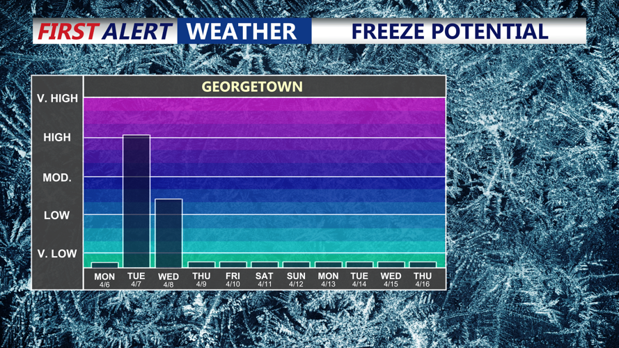
Freeze concerns as we go into Tuesday night, temperatures dipping below the freezing mark.
The coldest stretch of the week is expected Tuesday night into Wednesday morning as strong Canadian high pressure builds in. Clear skies, light winds, and a dry air mass will allow temperatures to drop into the low 20s to low 30s across much of Delmarva by daybreak Wednesday. There is a 50 to 60 percent chance that some locations fall to or below freezing, raising concerns for sensitive plants and early-season growth where the growing season is already active.
