



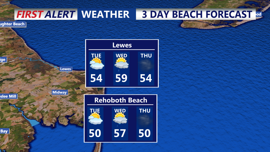

DELMARVA - The Delmarva coastline, from Sussex County to Ocean City, Maryland, will see another dry day Tuesday, but changes are on the horizon. The weather will take on an unsettled tone, with increasing clouds, stronger winds, and a warm-up ahead of an approaching storm system.
Tuesday Morning: Cool Start, Clouds on the Rise
If you’re stepping out early Tuesday, expect a crisp but not freezing morning. Temperatures will start in the low-to-mid 30s, slightly milder than previous nights, thanks to a steady southerly breeze.
Sunshine will be filtered by a growing layer of mid- and high-level clouds, a sign that the atmosphere is starting to shift. Winds from the south at 10 to 15 mph will steadily pick up, with gusts reaching 20-25 mph by midday—enough to put a bite in the otherwise mild air.
Tuesday Afternoon: Breezy and Mild
By lunchtime, temperatures will climb into the mid-to-upper 50s, marking one of the warmest days in recent weeks. Despite the warmer air, a stiff breeze will keep things feeling cooler along the immediate coast, especially in spots like Bethany Beach, Dewey Beach, and Ocean City.
Clouds will continue to build, gradually muting the sunshine. While no rain is expected just yet, humidity levels will begin creeping up, and you might notice a more unsettled feel in the air.
Tuesday Night: Milder but Cloudy
After sunset, temperatures will hold in the 40s rather than plummeting like they have in recent nights. The southerly wind, now gusting between 20-30 mph, will keep the air moving, making for a noticeably milder night.
Skies will be mostly cloudy, and while rain is unlikely before midnight, the coastal region will be well within the storm system’s influence by then. The ocean breeze will keep the air damp, and the first scattered showers may begin creeping in before sunrise Wednesday.
Midweek Changes: A Potent Storm Approaches
Tuesday’s breezy and mild conditions are just the precursor to a significant weather event arriving Wednesday into early Thursday. Here’s what to expect:
- Showers arriving by Wednesday afternoon – The first bands of rain will likely reach the coast later in the day, increasing in coverage and intensity by evening.
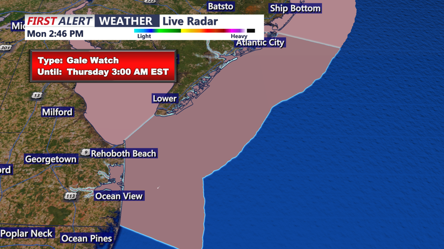
- Gusty winds exceeding 40 mph – Coastal areas, especially Ocean City and Fenwick Island, could see strong winds through Wednesday night.
- Chance of thunderstorms – Some isolated storms could pack an extra punch, especially across inland Delmarva.
- Heavy rain potential – A half-inch to an inch of rain is expected, with locally higher amounts possible.
The strongest impacts are likely from late Wednesday afternoon into early Thursday, with gusty winds continuing even after the rain moves out.
Thursday and Beyond: Windy and Cooler
By Thursday, lingering showers should taper off, but northwest winds will kick in, keeping temperatures cooler. Highs will drop back into the 50s, with a brisk breeze making it feel even chillier.
Looking ahead to the weekend, another storm system could bring more unsettled weather, but details remain uncertain.
For now, enjoy Tuesday’s mild weather—because things are about to get much more active along the coast. Stay tuned for updates as the midweek storm system approaches.
