


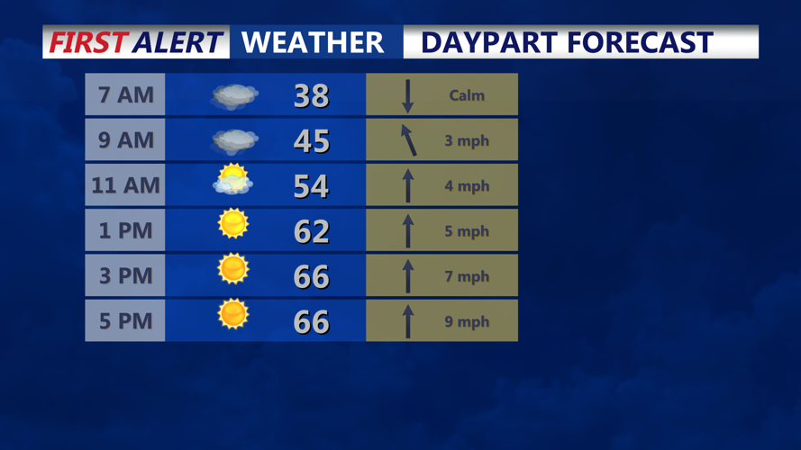

DELMARVA - The risk of frost in Sussex County has eased for late Thursday night as a southerly flow brings in slightly milder air, though some patchy frost still could form in colder inland spots before daybreak Friday.
Most overnight lows are expected to stay in the mid-30s, with areas closer to the coast likely remaining warm enough to avoid frost. More sheltered rural locations, however, could briefly dip near or just below freezing, especially away from the immediate shoreline.
The bigger concern overnight is the potential for low clouds and patchy fog. Relative humidity is expected to climb to near saturation, which could allow fog to form in spots by late Thursday night into early Friday. That may reduce visibility for some early-morning travelers.
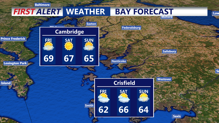
Through Friday, conditions are expected to remain mostly dry in Sussex County. Any meaningful rain chances appear limited until a cold front approaches Friday night, and even then, the chance of a wetting rainfall remains low.
Looking beyond Friday, dry weather is expected to continue through much of the weekend, although Saturday may bring an elevated risk of rapid fire spread behind the front as drier air and gusty northwest winds move in. A more significant warm-up is then expected early next week, with temperatures climbing well above normal by midweek.
