


The cold front is expected to push offshore by 7 p.m. Wednesday, ushering in significantly colder air overnight. Temperatures will drop quickly, with lows reaching the upper 20s to low 30s by Thursday morning. Winds from the west-northwest will remain gusty, peaking at 35 to 45 mph during the evening before gradually diminishing overnight.
Thursday will bring mostly clear to partly cloudy skies, but residents will notice a stark contrast in temperatures compared to earlier in the week. Highs will only reach the upper 30s to low 40s, and the gusty winds, blowing at 15 to 20 mph with occasional gusts of 20 to 30 mph, will make it feel at least 10 degrees colder. Wind chills could dip into the 20s during the day.
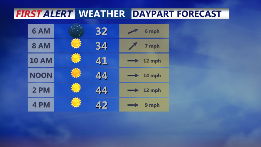
By Thursday night, high pressure moving in from the Great Lakes region will bring clearer skies and even colder conditions. Overnight lows are expected to drop into the upper teens and low 20s across Sussex County, making for a frigid start to Friday.
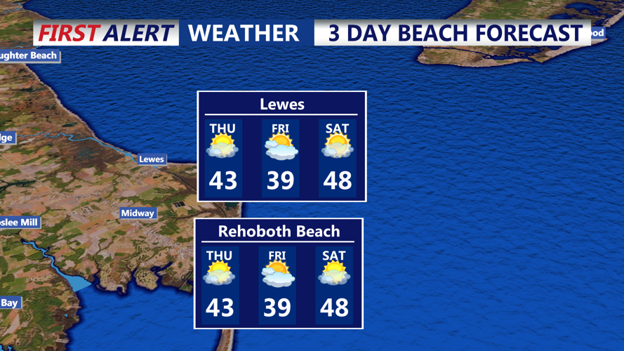
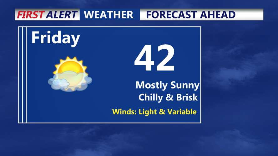
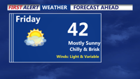
Friday will continue the cold trend, with highs struggling to reach the low 40s. Winds will be lighter compared to Thursday, but the day will still feel brisk under partly cloudy skies. Temperatures will remain well below seasonal averages, with Friday night bringing another round of subfreezing temperatures, dipping into the teens and low 20s.
The cold snap will persist into Saturday morning before temperatures begin to moderate slightly over the weekend. High pressure will dominate, keeping conditions dry, but a weak system could bring unsettled weather late Sunday into early next week.
Residents are encouraged to bundle up and take precautions for the cold and windy weather over the next few days, especially during morning and evening hours.