


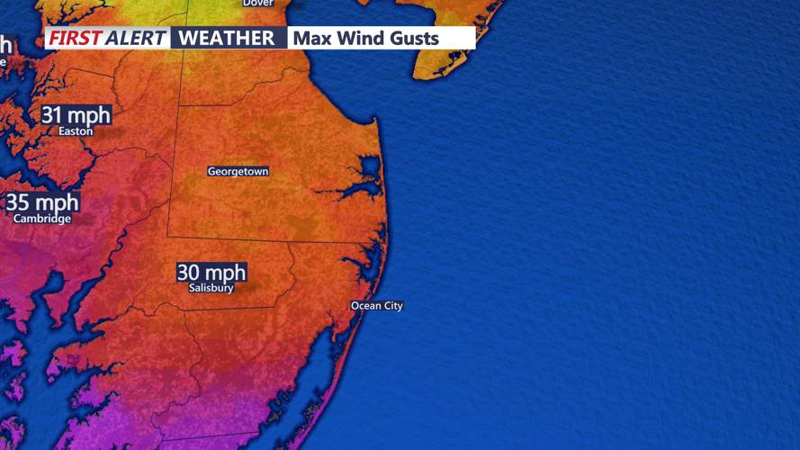
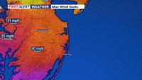


DELMARVA - Sussex County and Delmarva beach towns are set to experience a mix of weather patterns over the next few days as systems shift across the region.
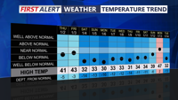
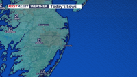
Tonight, high pressure remains in place to the southwest, keeping temperatures cold under clear skies. Expect lows ranging from the single digits inland to around 20 degrees near the coast.
On Thursday, the day will begin with some sunshine, but clouds will increase by midday. Light snow is forecasted to begin in the afternoon, continuing into the evening. Accumulations are expected to remain under an inch, but cold ground temperatures may cause slick conditions during the evening commute. Daytime highs will reach the low 30s, with overnight lows hovering around the teens and low 20s.
Friday offers a brief reprieve, with temperatures rebounding to the upper 30s to low 40s under mostly sunny skies. By Saturday, a warm front will lift through the area, bringing light rain by late morning. Widespread rainfall is expected in the afternoon and evening, accompanied by highs in the mid-40s. Snow is unlikely for Sussex County but may occur in higher elevations to the northwest.
Looking ahead, an arctic cold front is expected to sweep through on Sunday, potentially bringing a mix of rain and light snow. Behind the front, a significant cold air mass will dominate the region next week, with highs barely reaching the 20s and lows dipping into the single digits.
Residents are advised to prepare for rapidly changing conditions and take precautions against freezing temperatures and potential impacts to infrastructure next week.