


DELMARVA - After an arctic blast sent wind chills plummeting into the single digits, Sussex County residents will get some relief as high pressure takes control through the weekend. While temperatures remain below normal, a warming trend begins Saturday, bringing more comfortable conditions compared to the recent deep freeze.
Friday night: Expect clear skies and diminishing winds overnight as high pressure settles in. Temperatures will drop into the upper teens and low 20s across most of the county, with inland areas such as Bridgeville and Georgetown seeing the coldest lows. Coastal areas, including Lewes and Rehoboth Beach, will stay slightly milder but still brisk. Winds from the northwest at 10 to 15 mph will taper off to under 5 mph by dawn, making for a less biting chill than previous nights.
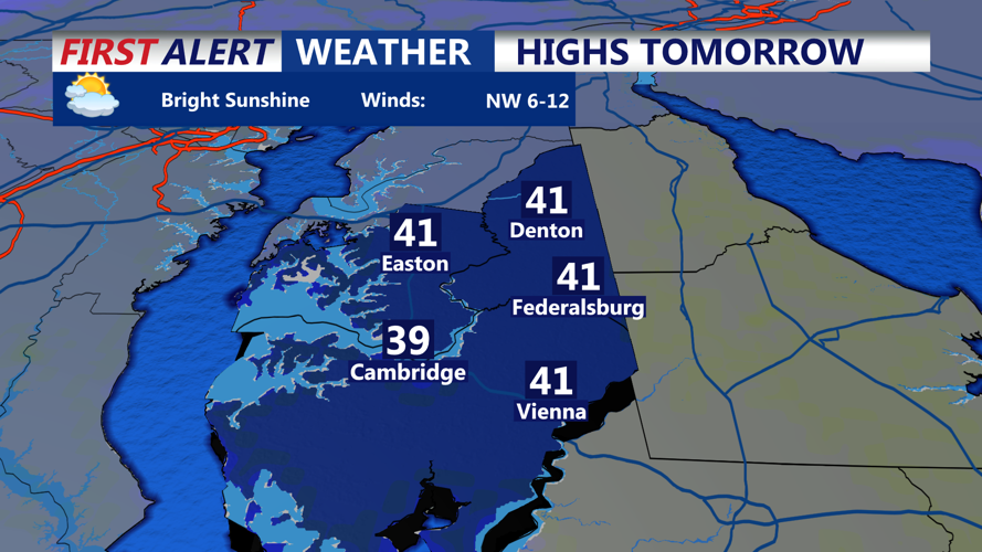
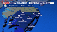
Saturday morning and afternoon: As the sun rises, expect calm and dry conditions with abundant sunshine. The wind will shift slightly west-southwest, picking up to around 10 mph in the afternoon. Temperatures will climb into the upper 30s inland and low 40s along the coast, including Bethany Beach and Fenwick Island. Although these temperatures remain a few degrees below normal, they’ll feel noticeably warmer compared to the arctic air earlier in the week.
What to wear: The bitter cold eases, but layers are still necessary. Start the morning with a heavier coat, hat, and gloves, especially if heading out early. By midday, a lighter jacket should suffice. Those planning outdoor activities should dress in layers that can be adjusted as temperatures rise through the afternoon.
Looking ahead: Saturday night will see a return to colder conditions, with lows in the mid-to-upper 20s, but Sunday brings slightly warmer air, with highs reaching the mid-40s under partly sunny skies. The warming trend continues into early next week, with temperatures edging closer to seasonal averages.
While no major storms are on the horizon, a weak disturbance could bring increased cloud cover Saturday night. However, precipitation is not expected. By Monday, a stronger system passing north of the region will enhance a southwest flow, pushing temperatures toward the upper 40s and low 50s.