


DELMARVA - Sussex County is headed into a colder and quieter stretch from late Tuesday evening through late Wednesday evening after a severe squall line swept across the region Monday night. National Weather Service forecasters said any lingering flurries or light snow showers Tuesday evening should fade, with clouds gradually giving way overnight. Inland Sussex is forecast to drop into the upper 20s Tuesday night, with northwest winds around 10 to 15 mph and gusts up to 25 mph easing as the night goes on.
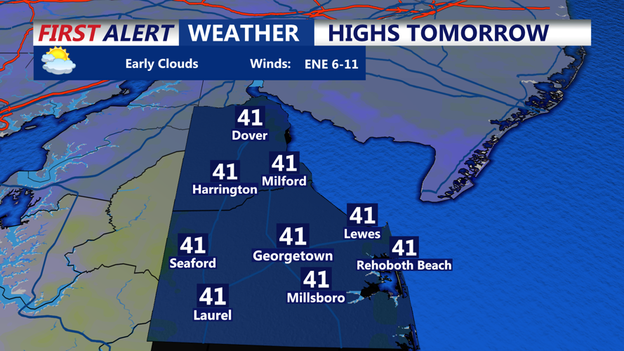
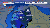
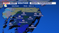
Wednesday is expected to bring a cool but mainly quiet day. The forecast calls for partly sunny skies in the morning, then increasing clouds in the afternoon, with highs in the low 40s. Winds should remain light, starting from the north before turning southeast later in the day. By late Wednesday evening, conditions are expected to stay dry and cold, with partly cloudy skies and temperatures falling toward the upper 20s overnight.
The calmer weather follows a storm survey Tuesday in which the National Weather Service office in Mount Holly, N.J., confirmed a preliminary EF1 tornado in Ridgely, Md., in Caroline County, with maximum winds estimated at 100 mph. The same survey found extensive straight-line wind damage of 70 to 90 mph in Queen Anne’s County, Md.