


DELMARVA - Calm and comfortable conditions will persist along the Delaware coast through early Thursday, as high pressure anchored offshore continues to dominate the region’s weather.
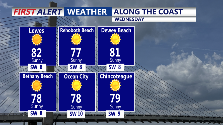
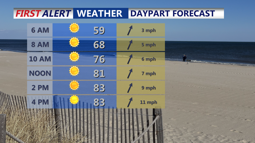
From early Wednesday into Thursday morning, beach towns including Rehoboth Beach, Dewey Beach, and Fenwick Island can expect quiet weather, with daytime highs in the upper 70s to low 80s and overnight lows dipping into the low to mid-60s. Skies will remain mostly clear, though some elevated haze and smoke may continue to hang over the region. Surface impacts are expected to remain minimal.
The persistent offshore high will begin to shift farther out to sea during the day on Thursday. As it does, clouds will gradually build across Sussex County, especially by Thursday afternoon. While most of the day will stay dry, a stalled cold front to the northwest will begin inching closer, setting the stage for increasing rain chances by early Friday.
By Friday morning, the approaching front is expected to draw moisture into the region, with forecast models suggesting precipitable water values rising to between 1.25 and 1.75 inches. This will create conditions favorable for isolated to scattered showers and possibly a thunderstorm. Any downpours that develop could produce brief heavy rain, especially inland and near the Route 1 corridor.
Despite the growing potential for wet weather, temperatures will continue to run above normal. Highs Thursday and Friday should range from the upper 70s near the coast to the upper 80s inland. Overnight lows will remain seasonably mild in the 60s.
Overall, the middle of the week offers another stretch of inviting beach weather, but conditions may begin to deteriorate as the weekend approaches.
