



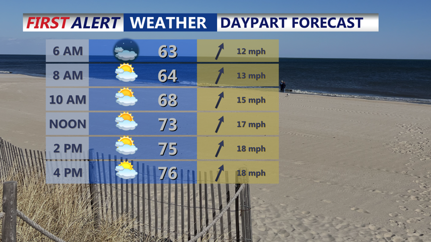

DELMARVA --Will close out the weekend with another mild evening, as temperatures struggle to dip below 60 degrees overnight—especially inland. This unseasonable warmth sets the stage for a dynamic shift in the weather pattern beginning Monday.

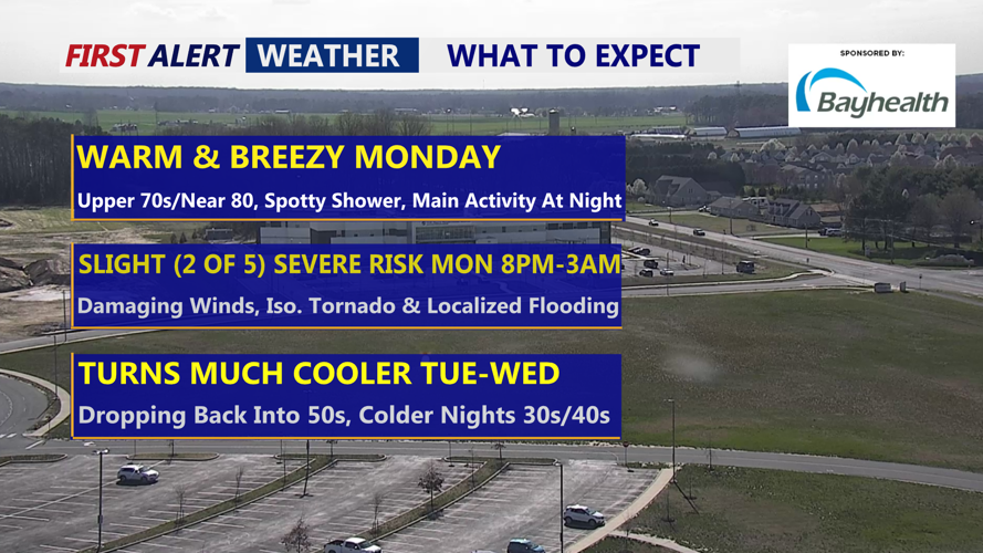
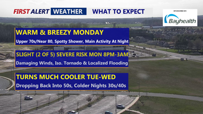
Monday expect another warm and breezy day ahead of a strong cold front.
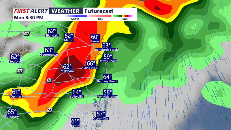
A strong cold front is expected to approach from the northwest Monday afternoon, sweeping across the region from west to east late Monday into early Tuesday morning. While forecast models still differ slightly on exact timing, most of Delmarva should expect the main impacts between 8 p.m. and 3 a.m., with scattered showers and thunderstorms possible ahead of the main line.

Storms expected to push through Delmarva starting around 8PM Monday.
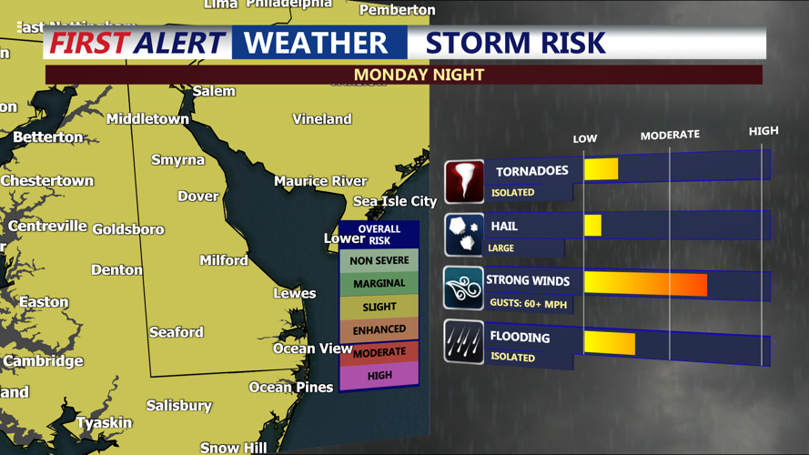
The Storm Prediction Center has placed the entire peninsula under a Slight Risk (2 of 5) for severe thunderstorms, with damaging wind gusts as the primary threat. However there is potential for an isolated tornadoes due to strong shear and elevated helicity, though confidence remains lower in that scenario.

Slight risk (2 of 5) for severe storms Monday night, damaging winds primary threat, can't rule out isolated tornado, localized flash flooding.
Rainfall totals are expected to range from 0.75 to 1.25 inches, with locally higher amounts possible. Heavy rain in a short period may still lead to isolated urban or low-lying flooding.
After the front clears early Tuesday, a surge of cooler air will arrive, accompanied by northwest winds gusting up to 30 mph. Skies will become increasingly sunny, with highs topping out in the mid upper 50s.
Tuesday night will bring the season’s coldest air yet, with widespread lows in the mid to upper 30s inland portions of Delmarva. Though temperatures may not quite justify frost advisories or freeze warnings, we are monitoring the potential for cold-sensitive areas.
By Wednesday, skies will start with some sun before clouds increase ahead of another system. Highs will remain in the 50s.
The latter half of the week turns more unsettled, with a warm front and cold front bringing shower chances Thursday and Friday. Highs in upper 70s to low 80s Friday. Additional low-pressure systems are likely over the weekend, keeping rain chances in play and temperatures cooler, with highs in the upper 60s to low 70s.
