


DELMARVA - We are bracing for unsettled weather through late Thursday as a combination of an approaching low pressure system and Hurricane Erin offshore threatens to bring a mix of rain, gusty winds, tidal flooding, and dangerous surf conditions.
Watches, Advisories and Warnings
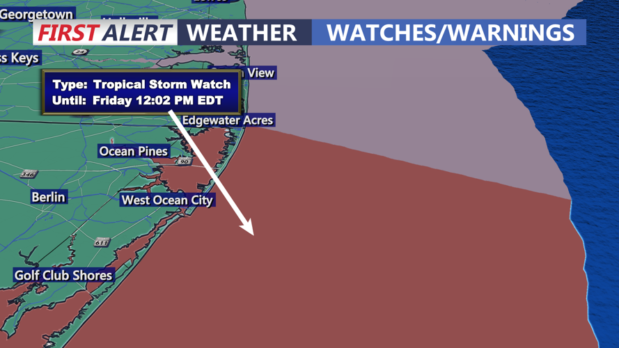
The National Weather Service has issued a series of watches and advisories for the Delmarva Peninsula, particularly for communities along the Atlantic coast in Sussex County, Maryland’s Wicomico County, and the resort towns stretching from Ocean City to Chincoteague.
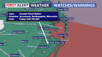
Coastal Flood Advisories and Warnings are in effect for the beaches and back bays, with the highest tides expected Thursday evening. Minor to moderate tidal flooding is likely in vulnerable coastal and back-bay locations.
High Surf Advisories warn of large breaking waves and life-threatening rip currents along the beaches. Beach erosion is also possible, especially at times of high tide.
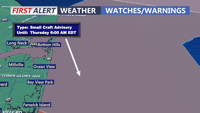
Small Craft Advisories and Gale Watches are posted for the coastal waters, where gusts may reach 40 mph and seas will be dangerous for mariners.
Wind Advisories may be needed as Erin makes its closest pass offshore Thursday, with gusts between 20 and 30 mph inland and higher along the coast.
Timing and Impacts
Late Tuesday Night into Wednesday: Showers and scattered thunderstorms will develop across the region as a weak front interacts with increasing Atlantic moisture. Skies will remain mostly cloudy, with highs in the upper 70s to low 80s across Delmarva.
Wednesday Night: Scattered showers linger, with a chance for heavier downpours north of the peninsula. Conditions remain breezy with increasing onshore flow.
Thursday: Hurricane Erin makes its closest approach offshore, passing 350 to 450 miles southeast of Delmarva. While the center stays well out to sea, its influence will be felt locally. Gusty northeast winds up to 40 mph will lash the coast, while widespread minor to moderate tidal flooding is expected with evening high tide. Dangerous surf and rip currents will pose significant hazards to beachgoers from Rehoboth Beach to Ocean City and southward toward Chincoteague.
Thursday Night into Friday: Conditions gradually improve as Erin moves north and east. Winds and seas begin to subside overnight, though rough surf will linger. By Friday, high pressure will return, bringing drier weather and highs in the upper 70s to low 80s.
Officials urge residents and visitors to heed all warnings, avoid flood-prone roadways during high tide, and stay out of the ocean until conditions improve.