



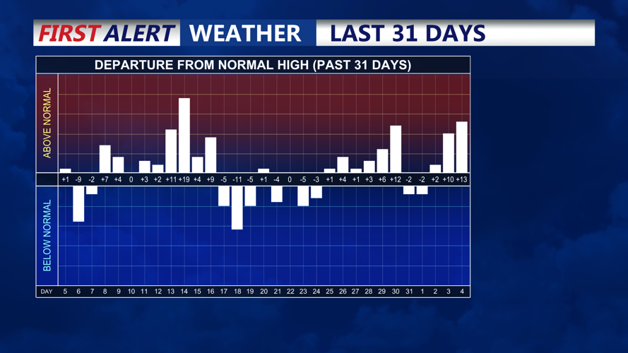

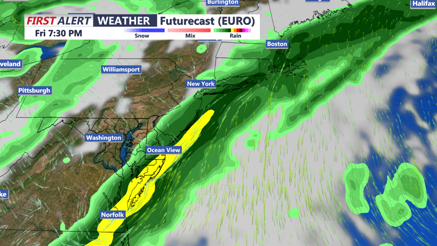
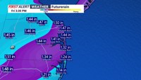

DELMARVA - Widespread rainfall will move across Sussex County Thursday evening and continue overnight into Friday as a slow-moving cold front approaches Delmarva, bringing much-needed moisture following several weeks of relatively dry weather.
After scattered light showers earlier Thursday, rain will become more widespread during the evening and overnight hours. Communities including Georgetown, Seaford, Laurel, Millsboro, Lewes and Rehoboth Beach can expect periods of steady rain, with occasional heavier downpours possible.
The slow-moving front will draw additional moisture into the region, increasing rainfall coverage and intensity overnight. A few thunderstorms cannot be ruled out, although the potential for thunder and lightning remains low.
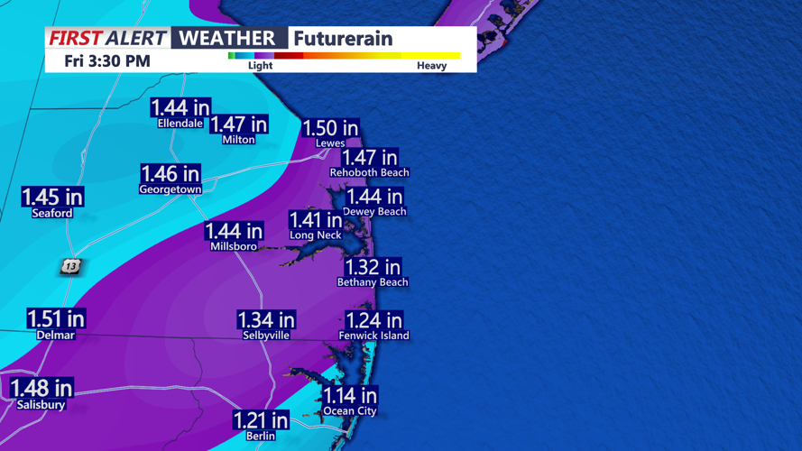
Rainfall totals across Sussex County and the surrounding Delmarva Peninsula are expected to range from 1 to 2 inches in some locations. The greatest amounts could develop across southern Delaware and nearby coastal communities, depending on where the front slows or temporarily stalls.
The rainfall will be particularly beneficial following a stretch of relatively dry weather over the past two to three weeks. Despite the potential for locally heavy rainfall, widespread flooding is not anticipated because the precipitation should fall over an extended period, allowing much of the water to soak into the ground or drain away.
Overnight temperatures will remain relatively mild ahead of the front, with southerly winds gradually weakening and shifting as the frontal boundary approaches.
By early Friday morning, widespread clouds, rain and areas of reduced visibility will remain across much of Sussex County. Wet roads and occasional heavier showers could create slower travel conditions during the morning commute, particularly along Route 1, Route 113 and Route 13.
The cold front is expected to slow or temporarily stall across the region Friday morning before resuming its southeastward movement during the afternoon. This delay could prolong rainfall across eastern Sussex County and the Delaware beaches.
Western communities, including Seaford, Laurel and Bridgeville, may begin experiencing improving conditions earlier Friday as the front moves farther east. However, areas closer to the Atlantic coast, including Lewes, Rehoboth Beach, Dewey Beach, Bethany Beach and Fenwick Island, could remain cloudy and damp through much of the afternoon.
Improvement will be gradual, with occasional showers and lingering clouds possible along the coast into Friday evening. Some beach communities may not experience significant clearing before sunset.
Winds will gradually shift to the northwest and north behind the front, bringing the beginning of a cooler and drier weather pattern.
Marine conditions will remain unsettled through Thursday night, with a Small Craft Advisory in effect for portions of the coastal waters. Increasing winds and rough seas will create hazardous conditions for smaller vessels, particularly along the Atlantic waters from Cape Henlopen south toward Fenwick Island and Ocean City, Maryland.
Winds and seas should gradually diminish Friday as the front moves through the region. However, periods of rain may continue to reduce visibility over Delaware Bay and the Atlantic coastal waters.
The front is expected to move offshore Friday night, allowing drier conditions to return to much of Sussex County by Saturday.
Although most of the weekend should be dry locally, another upper-level disturbance moving across the Northeast could produce additional showers farther north Saturday. Sussex County should remain largely outside that area of unsettled weather.
Temperatures will turn noticeably cooler behind the departing front, with afternoon readings generally falling into the upper 50s and lower 60s during the weekend. Overnight temperatures will also trend downward, with lows eventually reaching the 30s across some inland communities early next week.
Boaters should remain cautious through the weekend as another period of stronger west-northwest winds develops Saturday night into Sunday. Wind gusts could reach 30 to 35 mph over the coastal waters, with seas building to 4 to 6 feet. Additional Small Craft Advisories may be needed.
For residents and visitors along the Delaware beaches, the main weather concern Thursday evening through Friday evening will be the prolonged period of rain and the slow departure of the cold front.
While inland communities could begin drying out Friday afternoon, locations along the Route 1 beach corridor from Prime Hook and Lewes south through Fenwick Island may have to wait until Friday night or Saturday for more substantial improvement.
The arrival of cooler, drier air over the weekend will mark the end of the unsettled pattern, with generally fair weather expected to continue into early next week.
