


As of 7:30 PM EST on Tuesday, February 11, 2025, the Delaware Environmental Observing System (DEOS) and the Delaware Snow Monitoring Network have reported the following preliminary snowfall totals:
- Lewes: 5.2 inches
- Rehoboth Beach: 4.8 inches
- Georgetown: 5.5 inches
- Seaford: 5.0 inches
- Milford: 4.7 inches
- Laurel: 5.3 inches
- Millsboro: 5.1 inches
- Selbyville: 4.9 inches
- Bridgeville: 5.4 inches
- Dewey Beach: 4.6 inches
- Bethany Beach: 4.9 inches
- Fenwick Island: 4.7 inches
- Ellendale: 5.2 inches
- Greenwood: 5.3 inches
- Harbeson: 5.0 inches
- Long Neck: 4.8 inches
- Milton: 5.1 inches
- Ocean View: 4.9 inches
- Frankford: 5.0 inches
- Dagsboro: 5.1 inches
- Gumboro: 5.4 inches
- Blades: 5.0 inches
- Bethel: 5.3 inches
- Delmar: 5.5 inches
- Henlopen Acres: 4.7 inches
- South Bethany: 4.8 inches
- Slaughter Beach: 4.6 inches
In neighboring Maryland, the following accumulations have been observed:
- Ocean City: 5.0 inches
- Ocean Pines: 5.2 inches
These measurements are sourced from the Delaware Environmental Observing System (DEOS) and the Delaware Snow Monitoring Network.
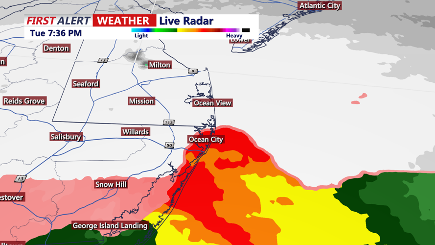
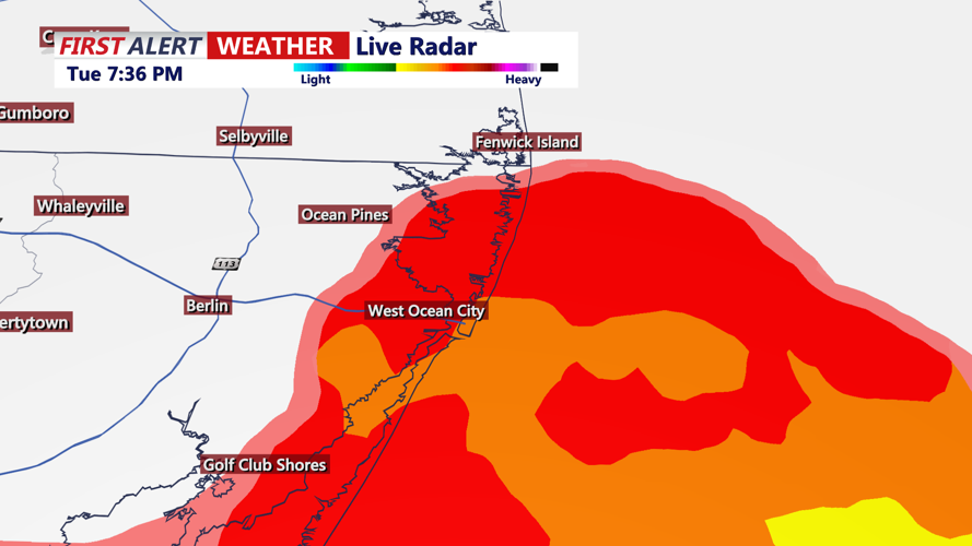
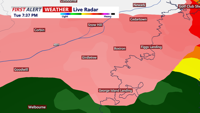
The National Weather Service in Mount Holly, New Jersey, has issued a Winter Storm Warning for portions of central and southern Delaware and northeast Maryland, effective until 7:00 AM EST Wednesday. Total snow accumulations are expected to range between 5 and 7 inches, with localized amounts potentially reaching up to 9 inches. Travel conditions are hazardous, and residents are advised to exercise caution during the Tuesday evening and Wednesday morning commutes.
Looking ahead, after a brief lull on Wednesday, another low-pressure system is anticipated to approach the region late Wednesday into Thursday. This system may bring a wintry mix, including snow, sleet, and freezing rain, particularly near and northwest of the I-95 corridor. Residents are encouraged to stay updated with the latest forecasts and prepare for potential impacts on travel and daily activities.
