


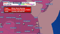

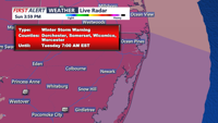

SUSSEX COUNTY – A winter storm warning is in effect for Sussex County as a powerful system moves into the region Sunday night, bringing heavy snow, ice, and potentially hazardous conditions. The National Weather Service in Mount Holly has issued advisories for snowfall totals ranging from 5 to 10 inches across much of the county, with localized amounts up to 12 inches. Southeastern portions of the county could see a mix of sleet and freezing rain, particularly later on Monday.
Timing and Forecast Details
The storm is expected to begin affecting Sussex County after midnight, with snow quickly intensifying during the early morning hours on Monday. By dawn, accumulations of 2 to 4 inches are likely, with heavier snowfall rates of over 1 inch per hour occurring through late Monday morning.
Temperatures will remain in the 20s overnight, keeping conditions favorable for snow. However, warmer air could introduce sleet or freezing rain in areas south of Dover and southeastern Sussex County. Precipitation will taper off to lighter snow and flurries Monday afternoon before potentially strengthening again in the evening as the storm redevelops offshore.
The system is expected to exit the area by early Tuesday morning, leaving behind windy and frigid conditions, with lows in the teens to near 20 degrees.
Hazards and Impacts
- Snow Accumulations: Most of Sussex County will see 5 to 10 inches of snow, with isolated totals of up to 12 inches. Mixing with sleet and freezing rain could limit snow totals in southeastern areas.
- Ice: Freezing rain and sleet could create slick conditions, particularly along coastal and southern Sussex County.
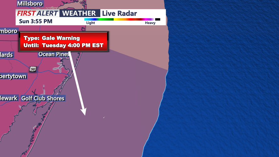
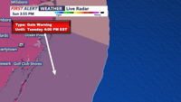
- Wind and Blowing Snow: Northwest winds of 15 to 25 mph, with gusts up to 40 mph, are expected Tuesday and Wednesday, which could lead to blowing and drifting snow.
Safety Tips
Residents are advised to take the following precautions:
- Travel: Avoid unnecessary travel as roads will become snow-covered and slippery. Reduced visibility and icy patches are likely.
- Power Outages: Prepare for possible power outages caused by ice accumulation and strong winds.
- Cold Temperatures: Bundle up, as wind chills will make temperatures feel like single digits on Tuesday and Wednesday.
- Emergency Supplies: Ensure you have enough food, water, and medications in case of prolonged impacts.
School and Business Impacts
Expect delays and closures across the region on Monday and possibly Tuesday as cleanup efforts get underway.
Stay Informed
For the latest updates on the storm, visit www.coasttv.com