


DELMARVA - We should prepare for a windy midweek followed by potential wintry conditions this weekend as weather patterns shift.
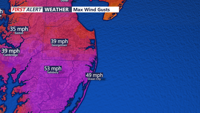
For Wednesday late evening, gusty winds will persist, although not as strong as earlier in the day. Wind gusts could still reach 35 to 40 mph as cold air continues to flow into the region, with overnight temperatures dropping to the mid-20s to low 30s. Skies will clear as the night progresses, but the chill will be palpable.
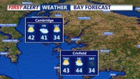
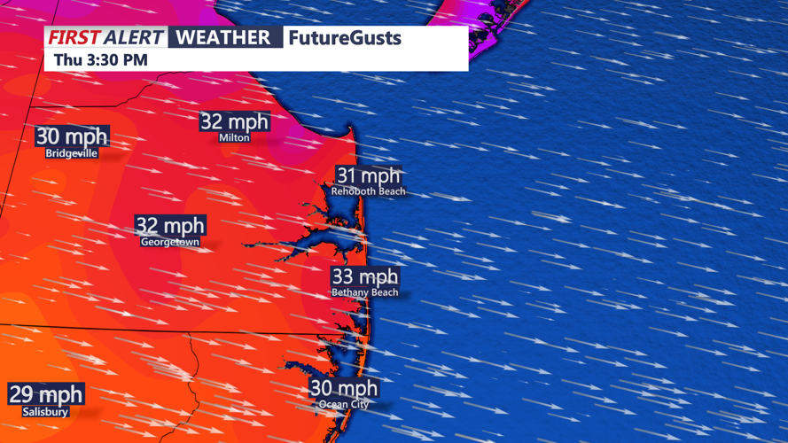
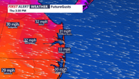
Thursday will see calmer weather by comparison, though the breezy conditions linger with gusts around 30 to 35 mph. Highs will range from the mid-30s to low 40s under sunny skies. The region will get a brief respite from the strong pressure gradient as high pressure moves closer from the southwest.
Heading into Friday, a weak low-pressure system will move through the Mid-Atlantic, bringing limited precipitation and a cold front. By the weekend, high pressure will dominate, ensuring mostly dry conditions and chilly temperatures.
The real weather story arrives late Sunday into Monday as a robust low-pressure system tracks into the Mid-Atlantic. While exact snowfall amounts and storm intensity remain uncertain, this setup has the potential to deliver significant snow across parts of the region. Residents are encouraged to monitor the forecast as details emerge over the coming days.
Key Weather Notes:
- Wind Advisory: Gusts of up to 50 mph Wednesday afternoon and evening; winds decrease but remain elevated overnight.
- Thursday: Sunny but breezy, with highs in the 30s to low 40s.
- Friday: Weak low-pressure system, minimal impacts expected.
- Weekend: High pressure in control, setting the stage for a possible snowstorm early next week.
Stay updated with the latest from the National Weather Service and local meteorologists as the weekend approaches. Delmarva could see its first significant snowstorm of the season.