


DELMARVA -- High pressure remains in control through Tuesday, keeping conditions dry while allowing temperatures to climb. Tuesday will mark the final completely dry day before a storm system arrives midweek. As high pressure moves offshore, a return flow will bring increasing humidity and temperatures climbing into the 50s to near 60 this afternoon. Winds will also become gusty at times, reaching 15-20 mph at times.
Late Tuesday night into early Wednesday, moisture increases, bringing a slight chance for showers overnight as a disturbance moves through. Low temperatures will be a bit milder, with lows in the 40s.

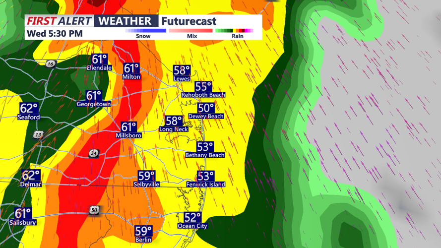
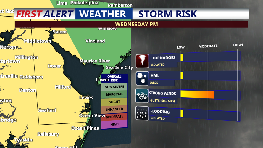
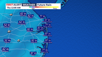
A strong cold front will then push through the region Wednesday into early Thursday, bringing periods of moderate to heavy rainfall, gusty winds, and possibly some strong to severe thunderstorms.

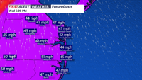
The severity of any storms depends on how far north a warm front lifts, which could create enough instability for strong to severe storms. The areas could experience thunderstorms, with damaging winds possible if storms develop. Non-thunderstorm winds could also gust 35-50 mph throughout the day Wednesday. An isolated tornado can't be ruled out.

Rainfall totals could range from 0.50 to 1.00 inches, with locally higher amounts possible in heavier downpours. Showers will taper off Wednesday night as drier air moves in. Lows in the 40s are expected.

By Thursday, high pressure returns, bringing drier conditions. Temperatures will remain mild, with highs in the 50s Thursday and slightly cooler on Friday.
Looking ahead to the weekend, another system may impact the region Saturday into Saturday night, though forecast models remain uncertain on its exact effects.
