


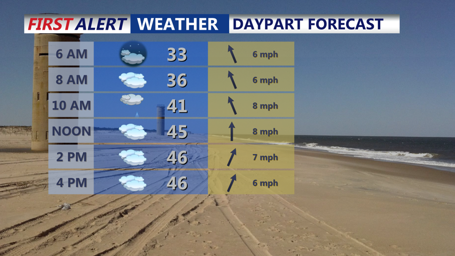


DELMARVA - Saturday will begin with increasing clouds as a warm front moves through the region. Light rain is expected across Sussex County, Delaware, and the Ocean City area during the daytime hours, with rainfall amounts remaining light, generally only a few hundredths of an inch. Temperatures will climb into the 40s, offering brief relief from colder conditions earlier in the week.
Rain may linger into Saturday evening, especially along the coast, before tapering off. Overnight, cloud cover will build again as a strong arctic cold front approaches. Lows will range from the lower 20s inland to the lower 30s near the coast, with limited cooling due to cloud cover.
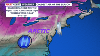
Sunday: Arctic Front and Snow Potential
Sunday morning will bring significant changes as a strong arctic cold front moves through the region. Temperatures will plummet throughout the day, accompanied by gusty winds as the frigid air mass settles in.
As the front passes, a secondary low-pressure system is expected to develop near the Carolina coastline. This system could bring accumulating snow to Delmarva by Sunday afternoon into the evening. While precise snow totals are uncertain, widespread light to moderate snowfall is possible, with accumulation dependent on the storm's track and intensity.
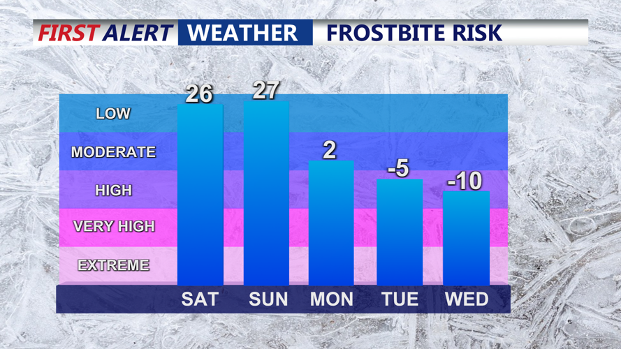
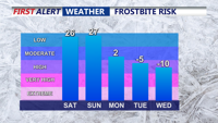
Sunday night will be bitterly cold, with lows dropping into the teens across much of the region. Wind chills may make it feel even colder, creating hazardous conditions for those outdoors.
Monday: Arctic Chill Takes Hold
Monday will mark the arrival of an arctic high-pressure system, bringing clear skies but frigid temperatures. Highs will struggle to reach the 20s, and well-below-normal temperatures are expected to persist through the middle of the week.
Outlook
Delmarva residents should prepare for a mix of light rain, potential snow, and a sharp drop in temperatures over the weekend. Travelers should stay informed about changing road conditions, especially Sunday into Monday, as snow and freezing temperatures could create hazardous conditions.