


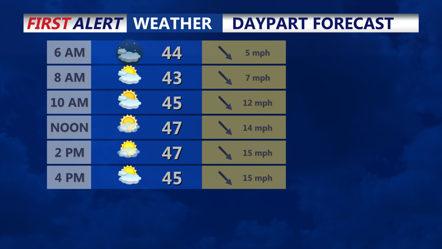


DELMARVA - Balmy start to our Wednesday, a warm front lifted through the region overnight helping temperatures stay well above the freezing mark. Temperatures have been in the 40s and 50s, a cold front will be pushing through this morning, so temperatures will dip a few degrees before rising back into the mid to upper 40s through the afternoon. We turn breezy with gusts to 30 mph out of the northwest under partly cloudy skies.
The bigger concern shifts to Wednesday night, Feb. 11, into early Thursday, Feb. 12, as colder air settles back in. Any leftover moisture on pavement could refreeze after dark, leading to scattered slick patches by early Thursday morning — especially in shaded areas, on elevated surfaces and on less-traveled roads.
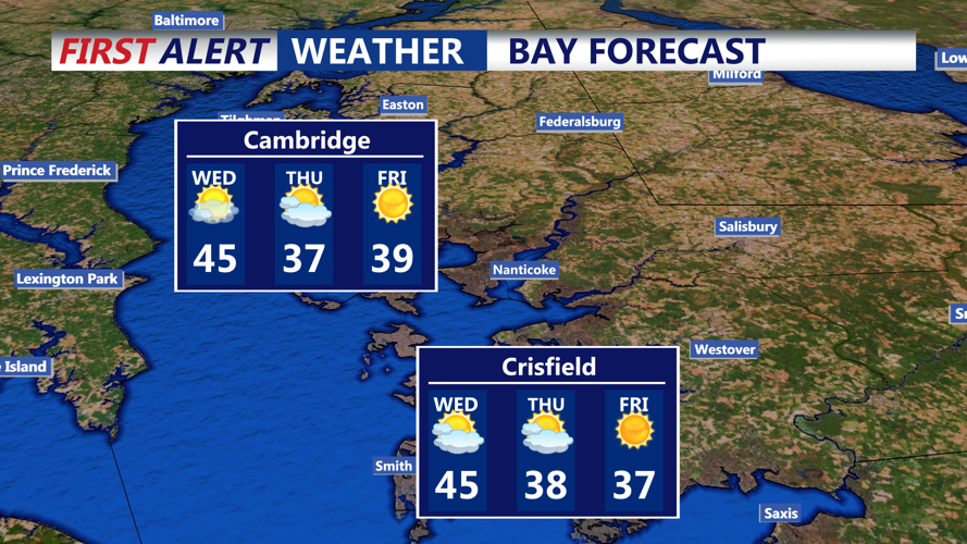
Looking ahead, the chance for impactful snow later this weekend into early next week has trended lower, though some precipitation remains possible late Sunday into Monday. Sussex County currently appears more likely to see rain or a mix rather than a significant snow event, with higher accumulation odds staying farther north.
