


DELMARVA - Friday morning will start off cold, with temperatures in the mid to upper 20s and wind chills making it feel like the teens. Skies will be mostly clear, but a brisk northwest wind at 10 to 15 mph, with occasional gusts over 25 mph, will keep conditions feeling quite chilly. High temperatures will struggle to reach the mid to upper 30s, and wind chills will remain in the 20s throughout the day.
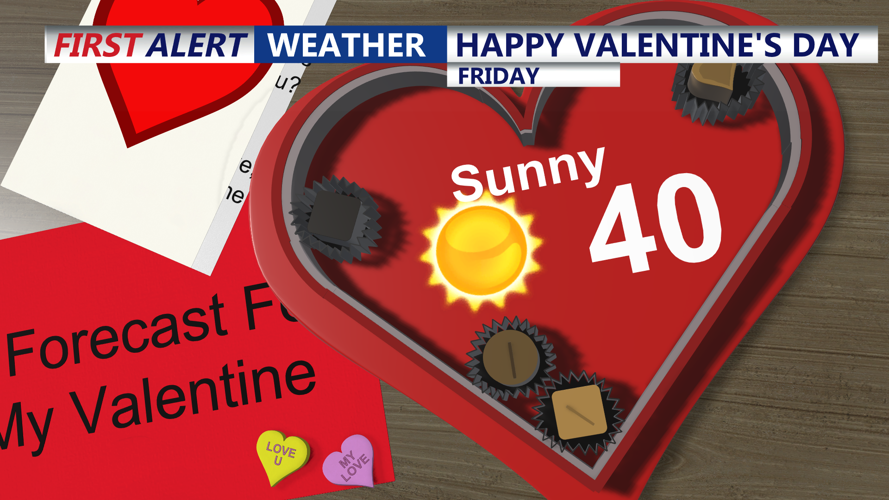
By Friday evening, temperatures will drop quickly into the 20s under mostly clear skies. Winds will begin to lighten slightly, but the cold air will remain firmly in place. If heading out for Valentine's Day celebrations, plan for temperatures in the low 20s with a noticeable breeze, making warm layers essential. A heavy coat, gloves, and a hat are recommended, especially for those walking along the boardwalk or near the water, where winds will feel more pronounced.
Overnight into early Saturday, high pressure will shift northeast, allowing for increasing cloud cover. Lows will fall to the low 20s, and winds will become lighter from the north. By Saturday morning, temperatures will slowly rise, but clouds will continue to thicken as a strong low-pressure system approaches from the west.
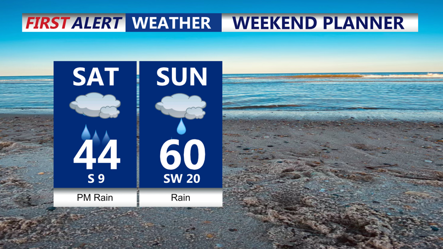
Saturday afternoon will remain dry, but overcast skies will dominate. Temperatures will climb to the low 40s, marking a slight warm-up, but a developing southeast wind at 10 to 15 mph will add to the chill. By late afternoon and evening, rain is expected to begin moving in from the west. As moisture increases, gusty winds will develop, with some areas along the coast seeing gusts over 30 mph.
Saturday night will be rainy and breezy, with temperatures holding steady in the upper 30s to low 40s. Some heavier downpours may develop overnight, and winds will continue to strengthen. Coastal areas could see localized flooding concerns, especially near inlets and low-lying areas. The storm system is expected to continue impacting the region into Sunday with continued rain and gusty winds.