


DELMARVA - Early Tuesday morning is expected to begin with areas of fog and low clouds across Sussex County and Ocean City, especially near the coast, bays and inland waterways, as warm, moist air continues moving into the region.
Visibility may be reduced at times around daybreak, with the thickest fog most likely in coastal and marine-adjacent locations. Farther inland, fog is expected to be more uneven and less widespread, though some motorists could still encounter patchy low visibility during the morning commute.
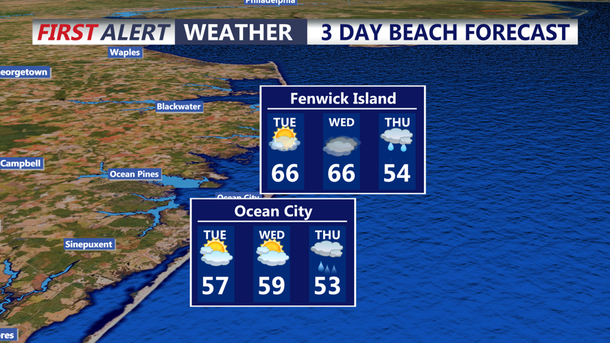
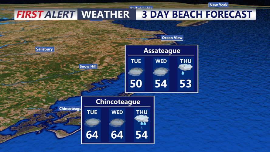
The fog should clear fairly quickly after sunrise Tuesday, giving way to abundant sunshine and much warmer temperatures by afternoon.
In Sussex County, highs are expected to climb into the 70s, bringing an early taste of spring. Ocean City is forecast to stay cooler because of the nearby Atlantic, but temperatures should still rise into the upper 50s to low 60s under mostly sunny skies.
By Tuesday evening, mild conditions are expected to continue as moisture gradually increases. Overnight into early Wednesday morning, patchy fog is likely to redevelop, with some locally dense fog possible near the coast and in low-lying areas.
The warmer, more humid pattern is expected to continue into Wednesday ahead of a strong cold front later in the week.
