


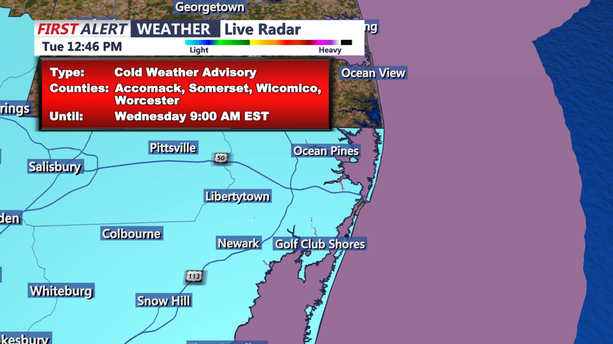


DELMARVA - Temperatures across Coastal Sussex County, Inland Sussex County, and cities east of U.S. Highway 113, including Ocean City, will start the day in the teens to low 20s. With brisk northwest winds gusting up to 30 mph, wind chill values will hover in the single digits. Residents are advised to bundle up, as frostbite can occur in under 30 minutes on exposed skin in such conditions.
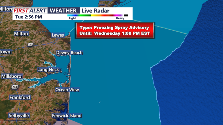
Mariners in the region will remain under a Freeze Spray Advisory, which warns of ice accretion on vessels. The advisory is in effect for offshore waters through mid-morning as temperatures remain critically low. Freezing spray can destabilize smaller craft, making navigation dangerous.
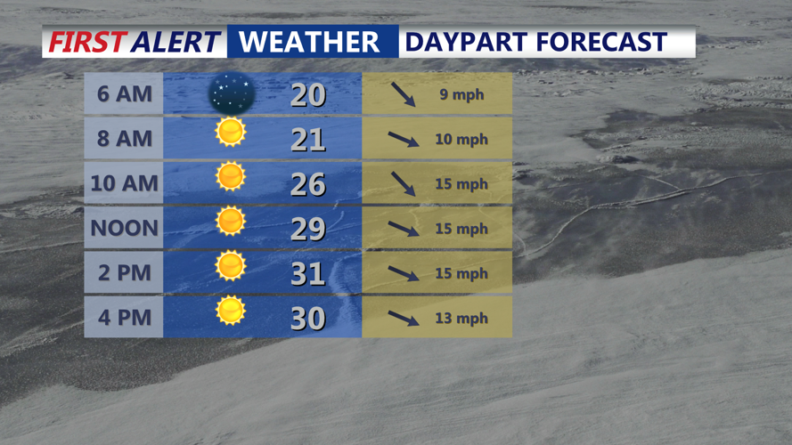
Wednesday Afternoon: Sunshine with Persistent Wind Chills
Sunny skies will dominate by midday, but temperatures will struggle to climb, with highs reaching only the upper 20s to mid-30s. Northwest winds will persist at 15-25 mph, maintaining wind chill values in the teens and 20s across the region.
A Gale Warning remains in effect for coastal waters, with gusts reaching 40 knots. Wave heights of 6-9 feet are expected, posing serious hazards for mariners. Coastal residents should also secure loose items to prevent wind damage. Despite the sunshine, outdoor conditions will remain uncomfortable due to the persistent wind and cold.
Wednesday Evening: Dangerous Overnight Lows
As the sun sets, temperatures will rapidly fall back into the teens, with wind chill values returning to the single digits. Inland areas of Sussex County and parts of Ocean City could see sub-zero wind chills, especially in exposed locations.
The brisk northwest winds will continue overnight, keeping the wind chill factor dangerously low. Those venturing out should dress in layers and avoid prolonged exposure. Frostbite and hypothermia risks remain high for individuals without proper protection.
Thursday Early Morning: Cold Start with Light Precipitation Possible
By early Thursday, a weak low-pressure system will approach the region, bringing increasing cloud cover and a slight chance of light snow or flurries. While the chance of measurable snow is low, residents may notice scattered flakes, particularly in areas northwest of Ocean City.
Temperatures will remain in the teens to low 20s during the early morning hours, but winds are expected to taper slightly. Despite the bitter start, Thursday’s system will begin to usher in slightly warmer air, with highs eventually climbing into the mid-30s.
Key Concerns for Residents and Mariners
Freeze Spray and Gale Warnings
- Mariners off the Sussex County coastline and around Ocean City face high risks from freezing spray and strong winds through Wednesday morning. Avoid unnecessary travel on the water, as conditions remain hazardous.
- Coastal residents should monitor conditions and be prepared for ice buildup on marine structures.
Wind Chill Safety
- With wind chills in the single digits to sub-zero range, frostbite can occur quickly. Residents are urged to dress in layers, cover exposed skin, and limit outdoor activity.
Road and Bridge Conditions
- Gusty winds may impact driving conditions on elevated roadways and bridges. Commuters should drive cautiously and anticipate sudden wind gusts, particularly during the early morning and evening hours.
Looking Ahead
Conditions will begin to moderate slightly by Thursday afternoon, with highs reaching the mid-30s under increasing clouds. A potential warming trend may bring relief heading into Friday, though another cold front is expected to arrive by the weekend, renewing concerns for icy conditions and possible snow showers.