


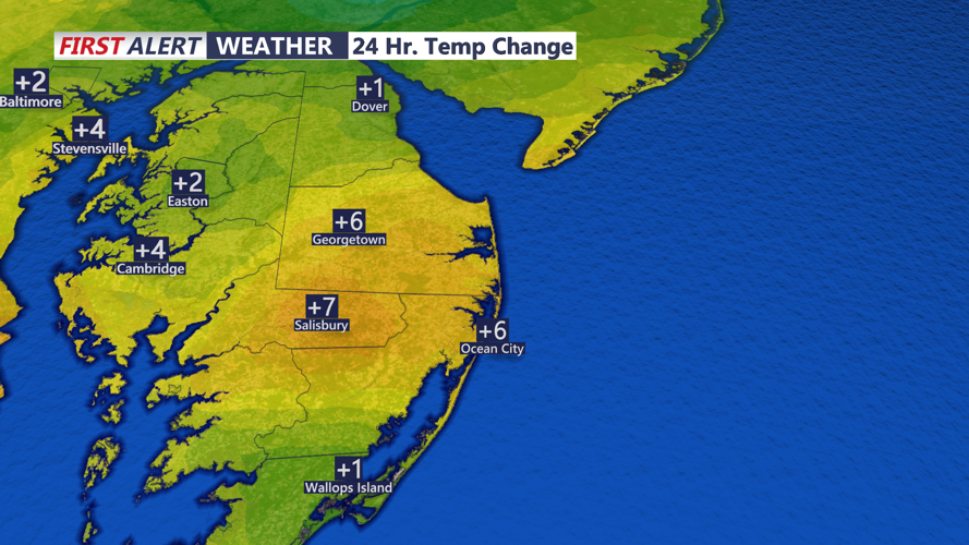


High pressure centered over southern New Jersey and the Delmarva Peninsula will move offshore late Sunday afternoon and evening, giving way to a passing upper-level trough that swings through the Northeast. While this disturbance brings light rain and even snow showers to far northern areas, Sussex County is expected to stay dry.
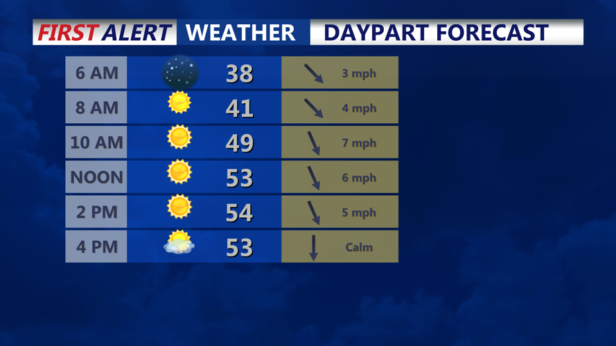
Skies will remain partly to mostly cloudy through Sunday evening, with clouds gradually scattering overnight behind the cold front. Winds should stay elevated enough to prevent significant radiational cooling, keeping overnight lows in the low to mid thirties across the county.
By Monday morning, northwest winds may briefly increase after sunrise, around ten to fifteen mph with gusts up to twenty mph. Winds ease later in the day and shift westward as another area of high pressure builds toward the Mid-Atlantic. Monday will feature partly to mostly sunny skies and seasonable highs in the low to mid fifties.
Quiet conditions continue into Monday night as high pressure moves overhead and offshore. Clouds return late as a warm front approaches ahead of a mid-week system expected to bring widespread rain beginning Tuesday and lasting into Wednesday.