


DELMARVA - A low-pressure system sweeping through the Mid-Atlantic Friday night delivered steady rainfall and patchy fog across Sussex County and coastal towns before moving offshore early Saturday. The system, originating from the Ohio Valley, tracked eastward, bringing periods of moderate to heavy rain before tapering off by dawn.
Friday Night Weather Impacts
Rainfall developed across the region by Friday evening, with totals ranging from around a half-inch in northern areas to nearly an inch in southern Sussex County. Coastal towns, including Rehoboth Beach, Lewes, and Bethany Beach, saw periods of heavier rain overnight before conditions began to improve. While thunderstorm activity remained limited due to low instability, areas of dense fog were reported, particularly near inland bays and marshlands.
Winds remained relatively light through much of the night but began to pick up from the northwest as the low-pressure system exited. Sustained winds of 10 to 15 mph, with gusts up to 25 mph, were observed in towns such as Georgetown, Millsboro, and Milford.
Saturday Morning Clearing, Breezy Conditions
By sunrise Saturday, precipitation had moved offshore, leaving behind overcast skies that gradually cleared through the morning. High pressure building in from the west led to drier conditions, though gusty northwest winds persisted throughout the day.
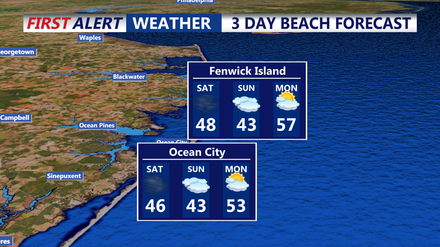
The strongest winds were recorded along the coastline, with gusts reaching 30 mph in Fenwick Island and Dewey Beach. Inland locations, including Bridgeville and Seaford, also experienced breezy conditions but saw slightly lower wind speeds.
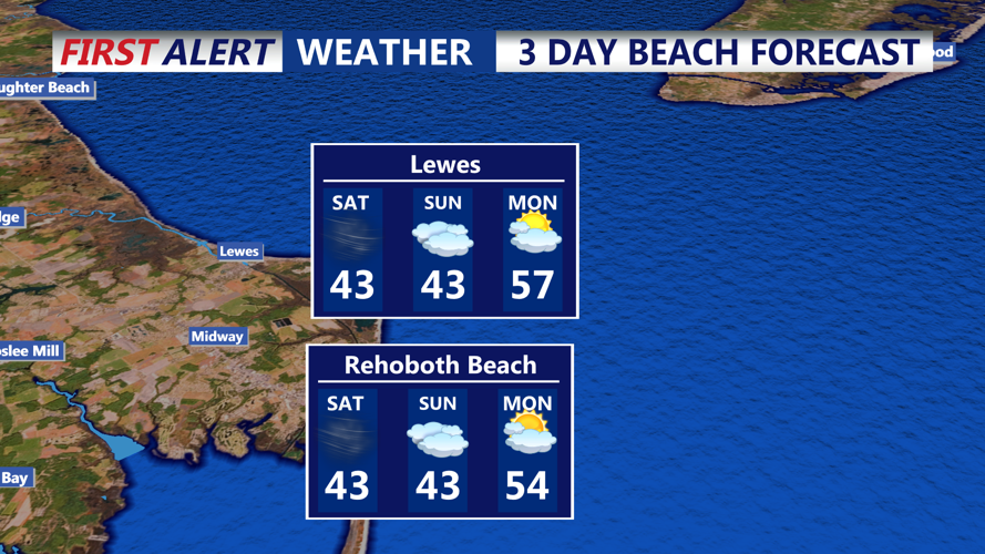
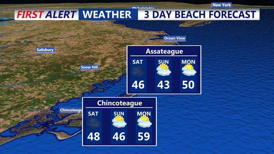
Temperatures on Saturday were seasonably cool, with highs ranging from the upper 30s inland to the mid-40s along the coast. Areas such as Ocean View and South Bethany managed to reach the mid-40s before cooler air moved in during the afternoon.
Looking Ahead: A Quiet But Chilly Night
Saturday night will bring clear skies and calm conditions as high pressure settles over the region. Temperatures will drop significantly, with lows in the low 20s inland and mid-to-upper 20s along the coast. Areas further north, such as Greenwood and Ellendale, may dip into the upper teens.
Sunday will see increasing clouds as a warm front lifts northward, though conditions will remain dry for much of the day. Temperatures will moderate slightly, with highs in the mid-to-upper 40s. A chance of light precipitation is expected late Sunday night, though any significant snowfall is likely to remain well north of Delmarva.