


DELMARVA - Skies will remain partly to mostly cloudy across Sussex County, Delaware, and Ocean City, Maryland, as a weak cold front moves through the region. While light rain showers are possible northwest of the I-95 corridor, any measurable precipitation is expected to be minimal, with only trace amounts recorded in most locations. Southwesterly winds will continue to pump in warmer air, keeping temperatures in the mid-60s through Tuesday afternoon before cooling down overnight. By early Wednesday morning, clearing skies will allow temperatures to drop into the low to mid-30s across the region.
Wednesday:
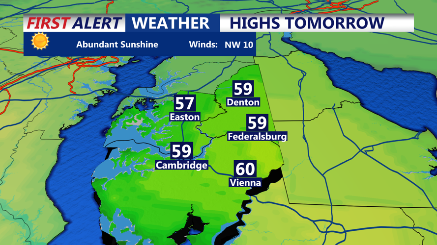
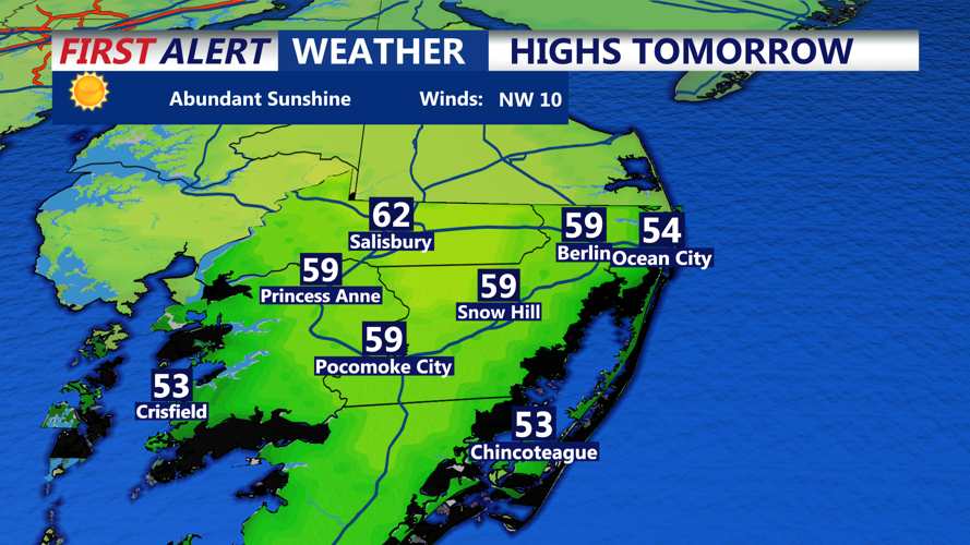
High pressure will build from the south, leading to a dry and seasonably mild day. Skies will be mostly sunny with highs reaching the upper 50s along the coast and low 50s inland. Winds will remain light, offering a calm and pleasant day overall.
Wednesday Night – Thursday Morning:
As an upper-level trough approaches from the west, a developing low-pressure system over the Great Lakes will bring increased cloud cover Wednesday night. A warm front lifting northward may generate scattered showers, particularly across northern Delmarva. While rainfall will be light, temperatures will remain elevated overnight, with lows in the mid-40s along the coast and upper 30s inland.
Thursday:
The warmest day of the week arrives as the warm front pushes north of the region. Widespread highs in the upper 50s to low 60s are expected, with a mix of clouds and sun. A cold front trailing behind will bring the potential for additional scattered showers by the afternoon, but overall, rain chances remain limited due to dry air in place.
Friday:
A noticeable shift in temperatures will arrive following the passage of Thursday’s cold front. Highs will struggle to reach the low 50s, with some inland areas only managing the upper 40s. Breezy northwest winds will make it feel even cooler.
Weekend Outlook:
Saturday will see a temporary rebound in temperatures ahead of another cold front. Highs will again reach the upper 50s to low 60s, but a strong push of cold air late Saturday night will bring a sharp drop in temperatures. By Sunday, highs will struggle to reach the mid-40s, and overnight lows could dip into the 20s across Sussex County and Ocean City. Winds will also increase, adding an extra chill to the air.
Looking Ahead:
Early next week will begin with continued cold temperatures, but a gradual warming trend is expected by Tuesday as high pressure moves offshore.
